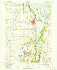
1955 Map of Tipp City
USGS Topo · Published 1956About this map
Tipp City sits at the heart of the Miami Valley, where the historic Miami and Erie Canal traces the western bank of the Miami River. In the mid-1950s, this area shows the clear intersection of early 19th-century water transport and modern 20th-century aviation infrastructure. The southern portion of the sheet is dominated by the sprawling Dayton Municipal Airport near Vandalia, while the river corridor is preserved within the Miami Conservancy District above the Taylorsville Dam. Traces of pioneer-era settlement are found in family-named burial grounds like English Cem and Reed Cem, alongside early thoroughfares such as the National Road and the Tippecanoe Turnpike. The landscape is a mix of developing suburban grids and established rural communities like West Charleston and Ginghamsburg.
Find a feature on this map
75 named features on this map. Tap any name to fly to it.
Don’t see what you’re looking for? This feature index may not catch every label — zoom into the map to look around manually.
Map Details
Editions of this 1955 Tipp City Map
This is the sole edition of this map. No revisions or reprints were ever made.
Other maps of this area

1904 · Dayton
USGS Topo · 1:62,500

1905 · Brookville
USGS Topo · 1:62,500

1906 · Dayton
USGS Topo · 1:62,500

1911 · Covington
USGS Topo · 1:62,500

1914 · Troy
USGS Topo · 1:62,500

1944 · Covington
USGS Topo · 1:62,500

1944 · Troy
USGS Topo · 1:62,500

1953 · Cincinnati
USGS Topo · 1:250,000

1953 · Muncie
USGS Topo · 1:250,000

1955 · West Milton
USGS Topo · 1:24,000