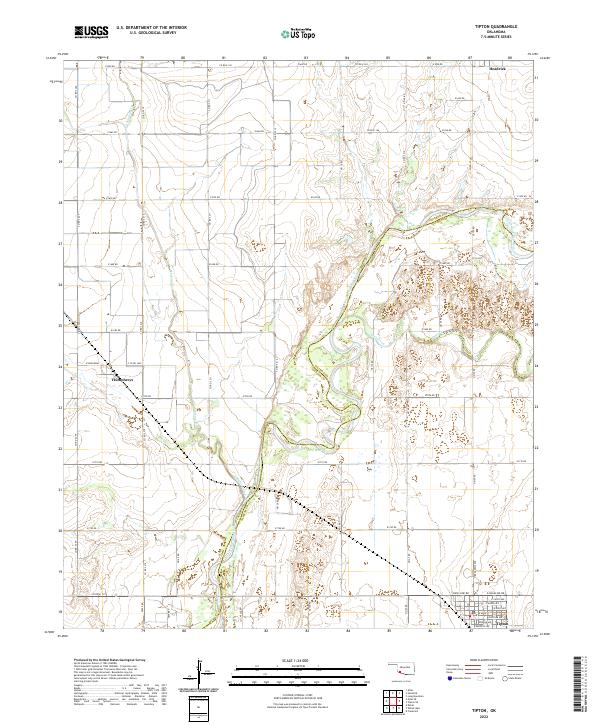
2022 Map of Tipton
USGS Topo · Published 2022About this map
The North Fork Red River meanders through the heart of this landscape, forming a natural boundary between Jackson and Tillman counties. This riverine system, joined by Otter Creek and Stinking Creek, defines the agricultural layout of the region. The settlement of Tipton serves as a primary hub in the south, with its grid extending to E Cafky Ave and Base Line Rd. To the north, the smaller communities of Headrick and Humphreys anchor the rural landscape, connected by a dense network of county roads such as E1650 Rd and E1700 Rd. The map illustrates a well-developed section-line road system that facilitates access to the fertile lands surrounding the river forks, reflecting the enduring agrarian character of this Southwest Oklahoma territory.
Find a feature on this map
59 named features on this map. Tap any name to fly to it.
Don’t see what you’re looking for? This feature index may not catch every label — zoom into the map to look around manually.
Map Details
Editions of this 2022 Tipton Map
This is the sole edition of this map. No revisions or reprints were ever made.
Other maps of this area

1955 · Lawton
USGS Topo · 1:250,000

1958 · Frederick
USGS Topo · 1:62,500

1958 · Elmer
USGS Topo · 1:62,500

1963 · Altus SE
USGS Topo · 1:24,000

1964 · Tipton SE
USGS Topo · 1:24,000

1964 · Altus
USGS Topo · 1:24,000

1964 · Tipton
USGS Topo · 1:24,000

1964 · Headrick
USGS Topo · 1:24,000

1964 · Long Mountain
USGS Topo · 1:24,000

1975 · Elmore City NE
USGS Topo · 1:24,000