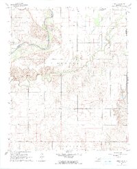
1964 Map of Tipton SE
USGS Topo · Published 1965About this map
The confluence of Otter Creek and the North Fork of the Red River dominates this southwestern Oklahoma landscape during the mid-1960s. Surveyed just before significant land-use changes, the map reveals a rural community anchored by social and religious centers such as the Pleasant Valley Ch and the nearby Pleasant Valley Community Hall. The terrain transitions from the low-lying river bottoms to the elevated areas of He Adrick and Hunter, with the St Louis San Francisco railroad cutting through the northwest corner. This era is characterized by an organized agricultural grid, punctuated by local infrastructure like the Pleasant Valley Landing Strip and the Center View Cem, providing a detailed record of the families and institutions established along the Jackson and Tillman County line.
Find a feature on this map
16 named features on this map. Tap any name to fly to it.
Don’t see what you’re looking for? This feature index may not catch every label — zoom into the map to look around manually.
Map Details
Editions of this 1964 Tipton SE Map
2 editions found
Other maps of this area

1950 · Snyder
USGS Topo · 1:62,500

1955 · Lawton
USGS Topo · 1:250,000

1956 · Manitou
USGS Topo · 1:24,000

1956 · Snyder
USGS Topo · 1:24,000

1956 · Snyder
USGS Topo · 1:62,500

1958 · Frederick
USGS Topo · 1:62,500

1964 · Tipton SE
USGS Topo · 1:24,000

1964 · Tipton
USGS Topo · 1:24,000

1964 · Headrick
USGS Topo · 1:24,000

1964 · Long Mountain
USGS Topo · 1:24,000