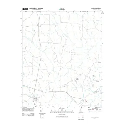
2012 Map of Tishomingo
USGS Topo · Published 2012About this map
Tishomingo serves as the primary hub in this corner of Northeast Mississippi, where the landscape is defined by the complex drainage of Cripple Deer Cr and its many tributaries. The area is dense with small, family-named landmarks and rural burial grounds, such as Spring Hill Cem near Midway and Hodge Cem to the south. The presence of Bruton Mound and the Natchez Trace Monument speaks to the deep human history of the region, marking layers of occupation from early indigenous periods through the pioneer era. Small communities like Mingo and Petertown are connected by a network of county roads that follow the ridges above local waters like Bear Cr and Trigger Br. The density of cemeteries, including Bethlehem Cem and Paradise Cem, provides a detailed record for those tracing local family lineages in this rural Mississippi landscape.
Find a feature on this map
103 named features on this map. Tap any name to fly to it.
Don’t see what you’re looking for? This feature index may not catch every label — zoom into the map to look around manually.
Map Details
Editions of this 2012 Tishomingo Map
This is the sole edition of this map. No revisions or reprints were ever made.
Other maps of this area

1911 · Iuka
USGS Topo · 1:48,000

1914 · Iuka
USGS Topo · 1:62,500

1935 · Holcut
USGS Topo · 1:24,000

1935 · Iuka
USGS Topo · 1:24,000

1935 · Leedy
USGS Topo · 1:24,000

1935 · Pleasant Site
USGS Topo · 1:24,000

1936 · Margerum
USGS Topo · 1:24,000

1936 · Belmont
USGS Topo · 1:24,000

1936 · Bishop
USGS Topo · 1:24,000

1936 · Tishomingo
USGS Topo · 1:24,000