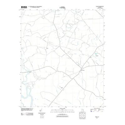
2011 Map of Tison
USGS Topo · Published 2011About this map
The Ohoopee River and Altamaha River converge in this southeastern corner of Georgia, defining a landscape of wetlands and winding waterways. This 2011 survey documents the rural character of Tattnall County, centered on the small settlements of Tison and Five Points. The drainage patterns are intricate, with Battle Creek and Watermelon Creek feeding the larger river systems. Genealogists will find several burial grounds noted, including Pine View Cemetery, Sand Hill Cemetery, and Stanfield Cemetery. Near the community of Tison, Surrencys Pond and its associated Surrencys Pond Dam stand as notable landmarks. The infrastructure is primarily composed of county routes, such as County Rd-293, which connect the scattered homesteads and timberlands that dominate the terrain between Cow Ford Bridge and the river forks.
Find a feature on this map
51 named features on this map. Tap any name to fly to it.
Don’t see what you’re looking for? This feature index may not catch every label — zoom into the map to look around manually.
Map Details
Editions of this 2011 Tison Map
This is the sole edition of this map. No revisions or reprints were ever made.
Other maps of this area

1919 · Claxton
USGS Topo · 1:62,500

1920 · Glennville
USGS Topo · 1:62,500

1944 · Claxton
USGS Topo · 1:62,500

1944 · Glennville
USGS Topo · 1:62,500

1946 · Brunswick
USGS Topo · 1:250,000

1947 · Savannah
USGS Topo · 1:250,000

1948 · Brunswick
USGS Topo · 1:250,000

1948 · Savannah
USGS Topo · 1:250,000

1950 · Glennville
USGS Topo · 1:62,500

1950 · Claxton
USGS Topo · 1:62,500