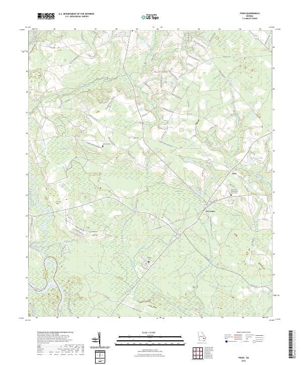
2024 Map of Tison
USGS Topo · Published 2024About this map
The confluence of the Ohoopee River and the Altamaha River defines the southern portion of this landscape at the boundary between Tattnall and Appling Counties. The rural settlement of Tison sits to the east, while the road junction at Five Points serves as a local hub near Watermelon Creek. This modern survey reveals a region characterized by numerous bay and pond features, such as Dinkins Bay, Padgett Bay, and Dukes Pond, alongside large tracts managed as the Farm Service Agency Interest of Georgia.
Find a feature on this map
94 named features on this map. Tap any name to fly to it.
Don’t see what you’re looking for? This feature index may not catch every label — zoom into the map to look around manually.
Map Details
Editions of this 2024 Tison Map
This is the sole edition of this map. No revisions or reprints were ever made.
Other maps of this area

1919 · Claxton
USGS Topo · 1:62,500

1920 · Glennville
USGS Topo · 1:62,500

1944 · Claxton
USGS Topo · 1:62,500

1944 · Glennville
USGS Topo · 1:62,500

1946 · Brunswick
USGS Topo · 1:250,000

1947 · Savannah
USGS Topo · 1:250,000

1948 · Brunswick
USGS Topo · 1:250,000

1948 · Savannah
USGS Topo · 1:250,000

1950 · Glennville
USGS Topo · 1:62,500

1950 · Claxton
USGS Topo · 1:62,500