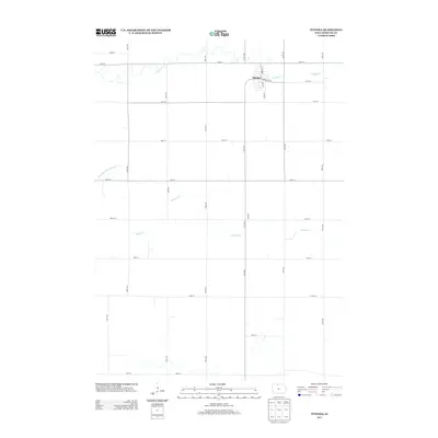
2013 Map of Titonka
USGS Topo · Published 2013About this map
Titonka stands as the primary settlement on this northern Iowa landscape, situated in an area defined by its highly organized agricultural grid and the natural meandering of Buffalo Cr. The town's layout reflects its rural heritage, centered on streets such as Main St N, Main St S, and the aptly named Elevator Ave E, which points toward the area's grain-handling history. Beyond the town limits, the terrain is shaped by the drainage patterns of Lindsey Cr and Drainage Ditch Number 175, illustrating the extensive water management required to support the productive farmland of Kossuth County. The map provides a precise view of the rural road network, with numbered avenues and streets like 200th Ave and 330th St forming a rigid geometric pattern across the prairie landscape.
Find a feature on this map
26 named features on this map. Tap any name to fly to it.
Don’t see what you’re looking for? This feature index may not catch every label — zoom into the map to look around manually.
Map Details
Editions of this 2013 Titonka Map
This is the sole edition of this map. No revisions or reprints were ever made.
Other maps of this area

1954 · Fairmont
USGS Topo · 1:250,000

1954 · Mason City
USGS Topo · 1:250,000

1957 · Mason City
USGS Topo · 1:250,000

1958 · Mason City
USGS Topo · 1:250,000

1958 · Fairmont
USGS Topo · 1:250,000

1972 · German Valley
USGS Topo · 1:24,000

1972 · Buffalo Center SW
USGS Topo · 1:24,000

1972 · Algona
USGS Topo · 1:24,000

1972 · Bancroft
USGS Topo · 1:24,000

1972 · Titonka
USGS Topo · 1:24,000