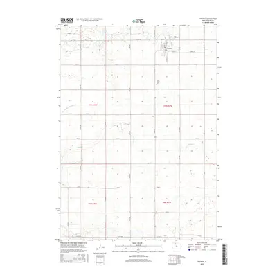
2015 Map of Titonka
USGS Topo · Published 2015About this map
Titonka stands as the central hub of this agricultural landscape in northern Iowa, situated amidst a highly engineered drainage system essential for the region's productivity. The map documents an intricate network of water management, featuring Drainage Ditch Number 175 and the meandering paths of Buffalo Cr and Lindsey Cr. These waterways, alongside the Michaelsen Marsh in the northern reaches, define the character of the terrain where the prairie has been meticulously partitioned into farm sections. For those researching local history or genealogy, the map identifies significant sites such as Good Hope Cem northeast of the town center and Buffalo Township Cem to the south. The layout of Titonka itself is clearly delineated, showing the residential street grid and local infrastructure that serves the surrounding rural community in Kossuth County.
Find a feature on this map
10 named features on this map. Tap any name to fly to it.
Don’t see what you’re looking for? This feature index may not catch every label — zoom into the map to look around manually.
Map Details
Editions of this 2015 Titonka Map
This is the sole edition of this map. No revisions or reprints were ever made.
Other maps of this area

1954 · Fairmont
USGS Topo · 1:250,000

1954 · Mason City
USGS Topo · 1:250,000

1957 · Mason City
USGS Topo · 1:250,000

1958 · Mason City
USGS Topo · 1:250,000

1958 · Fairmont
USGS Topo · 1:250,000

1972 · German Valley
USGS Topo · 1:24,000

1972 · Buffalo Center SW
USGS Topo · 1:24,000

1972 · Algona
USGS Topo · 1:24,000

1972 · Bancroft
USGS Topo · 1:24,000

1972 · Titonka
USGS Topo · 1:24,000