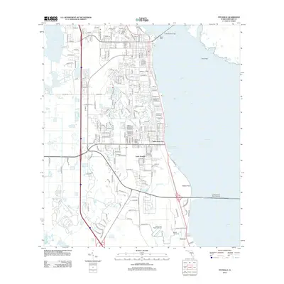
2012 Map of Titusville
USGS Topo · Published 2012About this map
Indian River City and South Titusville anchor the western shore of the Indian River in this 2012 topographic survey, which highlights the area's deep connection to the aerospace industry. The transport network reflects this legacy through names like NASA Parkway West Causeway, Challenger Ave, and Vectorspace Blvd. Beyond the residential neighborhoods, the landscape is defined by vast waterways and coastal features, including the A. Max Brewer Bridge crossing toward the Merritt Island National Wildlife Refuge. To the south, the Space Coast Regional Airport and the nearby community of Bellwood represent the transition toward the Kennedy Space Center complex. Natural features such as Blue Hole, Burns Hammock, and the marshy expanses of Brock Flats remain visible amidst the suburban development and the corridor of the Fec railroad. The map provides a detailed view of the lagoon-side infrastructure, from the Westland Marina at Sand Point to the various creeks feeding into the river.
Find a feature on this map
192 named features on this map. Tap any name to fly to it.
Don’t see what you’re looking for? This feature index may not catch every label — zoom into the map to look around manually.
Map Details
Editions of this 2012 Titusville Map
This is the sole edition of this map. No revisions or reprints were ever made.
Other maps of this area

1949 · Orsino
USGS Topo · 1:24,000

1949 · Titusville
USGS Topo · 1:24,000

1949 · Courtenay
USGS Topo · 1:24,000

1949 · Wilson
USGS Topo · 1:24,000

1949 · Mims
USGS Topo · 1:24,000

1949 · Sharpes
USGS Topo · 1:24,000

1950 · Aurantia
USGS Topo · 1:24,000

1951 · Courtenay
USGS Topo · 1:24,000

1951 · Sharpes
USGS Topo · 1:24,000

1951 · Orsino
USGS Topo · 1:24,000
Featured Places
- Titusville, FL
- Indian River City, Titusville
- Bellwood, FL
- Whispering Hills Golf Estates, Titusville
- South Titusville, FL