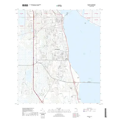
2018 Map of Titusville
USGS Topo · Published 2018About this map
Titusville serves as the focal point of this coastal landscape, situated where the Florida East Coast Railway runs parallel to the western shores of the Indian River. The map details a dense network of suburban development stretching from South Lake in the north down through the communities of Indian River City and Bellwood. Notable landmarks like the Space Coast Regional Airport and Arthur Dunn Air Park emphasize the region's aviation character, while the A. Max Brewer Bridge provides a vital connection across the Indian River Lagoon at Sand Point.
Find a feature on this map
185 named features on this map. Tap any name to fly to it.
Don’t see what you’re looking for? This feature index may not catch every label — zoom into the map to look around manually.
Map Details
Editions of this 2018 Titusville Map
This is the sole edition of this map. No revisions or reprints were ever made.
Other maps of this area

1949 · Orsino
USGS Topo · 1:24,000

1949 · Titusville
USGS Topo · 1:24,000

1949 · Courtenay
USGS Topo · 1:24,000

1949 · Wilson
USGS Topo · 1:24,000

1949 · Mims
USGS Topo · 1:24,000

1949 · Sharpes
USGS Topo · 1:24,000

1950 · Aurantia
USGS Topo · 1:24,000

1951 · Courtenay
USGS Topo · 1:24,000

1951 · Sharpes
USGS Topo · 1:24,000

1951 · Orsino
USGS Topo · 1:24,000
Featured Places
- Titusville, FL
- Indian River City, Titusville
- Bellwood, FL
- Whispering Hills Golf Estates, Titusville
- South Titusville, FL