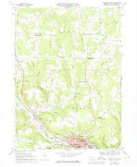
1968 Map of Titusville North
USGS Topo · Published 1975About this map
The industrial and educational hub of Titusville anchors the southern portion of this landscape, where the Univ of Pittsburgh at Titusville and St Josephs High Sch sit near the winding banks of Oil Creek. This 1968 survey reveals a terrain defined by its namesake resource, with numerous Oil Wells peppered across the eastern hills near Vrooman and Shelmadine Springs. The rural uplands are characterized by a series of crossroads settlements, such as McLaughlin Corners and Cloverdale Corners, each serving as a local node for the surrounding farmsteads.
Find a feature on this map
67 named features on this map. Tap any name to fly to it.
Don’t see what you’re looking for? This feature index may not catch every label — zoom into the map to look around manually.
Map Details
Editions of this 1968 Titusville North Map
2 editions found
Other maps of this area

1927 · Townville
USGS Topo · 1:48,000

1927 · Titusville
USGS Topo · 1:62,500

1929 · Corry
USGS Topo · 1:48,000

1929 · Union City
USGS Topo · 1:62,500

1932 · Corry
USGS Topo · 1:62,500

1932 · Townville
USGS Topo · 1:62,500

1932 · Union City
USGS Topo · 1:62,500

1933 · Titusville
USGS Topo · 1:62,500

1945 · Townville
USGS Topo · 1:62,500

1957 · Warren
USGS Topo · 1:250,000