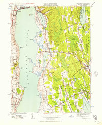
1949 Map of Tiverton
USGS Topo · Published 1957About this map
The Sakonnet River dominates this coastal landscape, separating the mainland of Tiverton and Little Compton from the eastern shore of Rhode Island and the northern tip of Middletown. At the close of the 1940s, the region remains largely rural, defined by a network of local thoroughfares like Main Road and Long Highway connecting historic inland crossroads. In Little Compton Commons, a concentrated cluster of structures marks the civic center, while smaller hamlets like Tiverton Four Corners and Adamsville serve as vital community hubs near the Massachusetts border.
Find a feature on this map
81 named features on this map. Tap any name to fly to it.
Don’t see what you’re looking for? This feature index may not catch every label — zoom into the map to look around manually.
Map Details
Editions of this 1949 Tiverton Map
4 editions found
Other maps of this area

1885 · Sakonnet
USGS Topo · 1:62,500

1888 · Fall River
USGS Topo · 1:62,500

1888 · Sakonnet
USGS Topo · 1:62,500

1889 · Newport
USGS Topo · 1:62,500

1890 · Narragansett Bay
USGS Topo · 1:62,500

1892 · Narragansett Bay
USGS Topo · 1:62,500

1893 · Sakonnet
USGS Topo · 1:62,500

1893 · Fall River
USGS Topo · 1:62,500

1894 · Newport
USGS Topo · 1:62,500

1904 · Newport
USGS Topo · 1:62,500