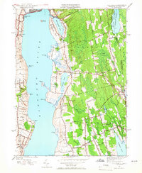
1949 Map of Tiverton
USGS Topo · Published 1966About this map
Little Compton and the surrounding coastal uplands of Tiverton are defined by a network of colonial-era roads and scattered agricultural hamlets in this mid-century survey. The landscape east of the Sakonnet River retains a distinctively rural character, where family-named landmarks like Richmond Hill and Wilcox Hill overlook tidal inlets and ponds. Religious and educational life centers on small gathering points such as Amicable Ch, St Madeleines Ch, and the Nonquit Sch.
Find a feature on this map
91 named features on this map. Tap any name to fly to it.
Don’t see what you’re looking for? This feature index may not catch every label — zoom into the map to look around manually.
Map Details
Editions of this 1949 Tiverton Map
4 editions found
Other maps of this area

1885 · Sakonnet
USGS Topo · 1:62,500

1888 · Fall River
USGS Topo · 1:62,500

1888 · Sakonnet
USGS Topo · 1:62,500

1889 · Newport
USGS Topo · 1:62,500

1890 · Narragansett Bay
USGS Topo · 1:62,500

1892 · Narragansett Bay
USGS Topo · 1:62,500

1893 · Sakonnet
USGS Topo · 1:62,500

1893 · Fall River
USGS Topo · 1:62,500

1894 · Newport
USGS Topo · 1:62,500

1904 · Newport
USGS Topo · 1:62,500