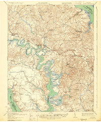
1918 Map of Toano
USGS Topo · Published 1930About this map
The Chickahominy River carves a deep, winding path through the heart of the Virginia Peninsula in this early 20th-century survey. The landscape is defined by its intricate waterways and numerous marshy islands, including Wright Island, Parsons Island, and Gordon Island. Transportation in the era is a mix of the old and new, with the Chesapeake and Ohio railroad cutting across the terrain through Lanexa and Toano, while traditional river access points like Cypress Bank Landing and Barrets Ferry Landing remain vital.
Find a feature on this map
93 named features on this map. Tap any name to fly to it.
Don’t see what you’re looking for? This feature index may not catch every label — zoom into the map to look around manually.
Map Details
Editions of this 1918 Toano Map
3 editions found
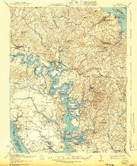
Other maps of this area

1906 · Williamsburg
USGS Topo · 1:62,500

1907 · Yorktown
USGS Topo · 1:62,500

1917 · Urbanna
USGS Topo · 1:62,500

1917 · Toano
USGS Topo · 1:62,500

1918 · Charles City
USGS Topo · 1:62,500

1918 · Toano
USGS Topo · 1:62,500

1919 · Surry
USGS Topo · 1:62,500

1919 · Disputanta
USGS Topo · 1:62,500

1919 · New Kent
USGS Topo · 1:62,500

1920 · King William
USGS Topo · 1:62,500