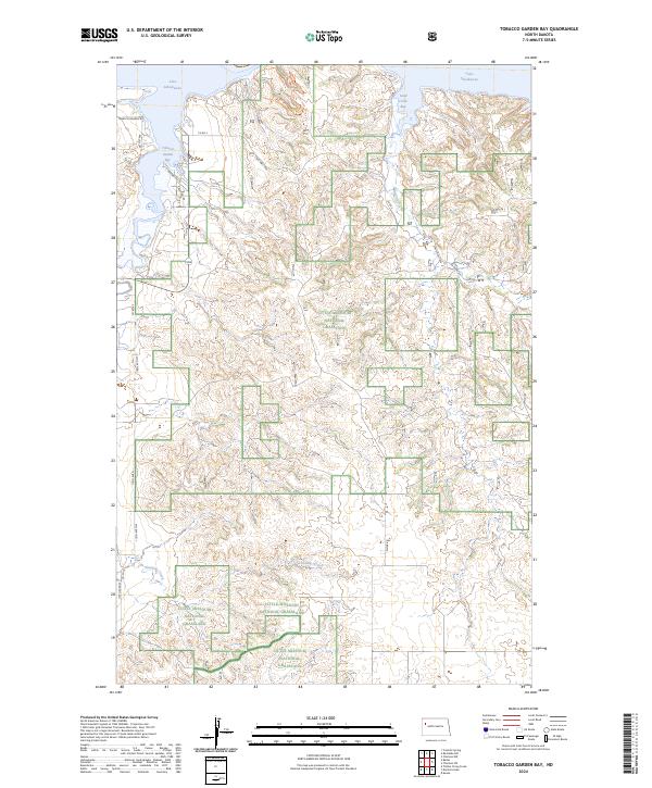
2024 Map of Tobacco Garden Bay
USGS Topo · Published 2024About this map
Little Missouri National Grassland encompasses much of this territory in McKenzie County, showing a complex mosaic of public and private land boundaries in the Missouri River breaks. The northern edge is dominated by the sprawling waters of Lake Sakakawea, where prominent inlets like Tobacco Garden Bay and Sand Creek Bay reach into the broken plateau. These bays reflect the modern shoreline of the reservoir, creating a distinctive geography where high prairie ridges meet the water's edge.
Find a feature on this map
24 named features on this map. Tap any name to fly to it.
Don’t see what you’re looking for? This feature index may not catch every label — zoom into the map to look around manually.
Map Details
Editions of this 2024 Tobacco Garden Bay Map
This is the sole edition of this map. No revisions or reprints were ever made.
Other maps of this area

1911 · Ray
USGS Topo · 1:125,000

1953 · Williston
USGS Topo · 1:250,000

1953 · Watford City
USGS Topo · 1:250,000

1957 · Williston
USGS Topo · 1:250,000

1957 · Watford City
USGS Topo · 1:250,000

1965 · Keene
USGS Topo · 1:24,000

1965 · Charlson SW
USGS Topo · 1:24,000

1965 · Charlson NW
USGS Topo · 1:24,000

1967 · Watford City
USGS Topo · 1:250,000

1969 · Cussicks Spring
USGS Topo · 1:24,000