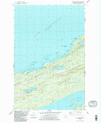
1985 Map of Todd Harbor
USGS Topo · Published 1986About this map
Isle Royale National Park dominates this 1985 survey, showing the intricate north-shore topography where the island meets Lake Superior. The landscape is defined by parallel geologic formations, most notably Minong Ridge and Greenstone Ridge, which create a series of elongated valleys and lakes. Within this wilderness, the map records the Haytown Mine, a remnant of the island's copper mining history located near the shores of Todd Harbor.
Find a feature on this map
28 named features on this map. Tap any name to fly to it.
Don’t see what you’re looking for? This feature index may not catch every label — zoom into the map to look around manually.
Map Details
Editions of this 1985 Todd Harbor Map
2 editions found
Other maps of this area

1958 · Hancock
USGS Topo · 1:250,000

1959 · Fort William
USGS Topo · 1:250,000

1960 · Hancock
USGS Topo · 1:250,000

1961 · Hancock
USGS Topo · 1:250,000

1966 · Hancock
USGS Topo · 1:250,000

1968 · Fort William
USGS Topo · 1:250,000

1985 · Todd Harbor
USGS Topo · 1:100,000

1985 · Siskiwit Bay
USGS Topo · 1:100,000
1985 · Lake Richie
USGS Topo · 1:24,000
1985 · Todd Harbor
USGS Topo · 1:24,000