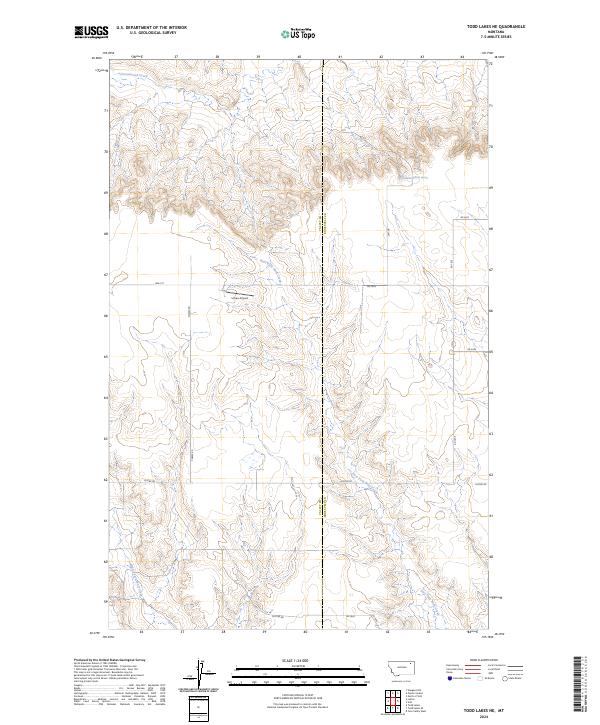
2024 Map of Todd Lakes NE
USGS Topo · Published 2024About this map
East Fork Wolf Creek and Middle Fork Wolf Creek carve through this landscape at the boundary of Valley and Roosevelt counties. The map reflects a rural economy defined by wide-open ranching and farming tracts, where the private Unrau Airport provides a vital aerial link for the remote plains. This 2024 survey documents a network of section-line roads, including Lustre Rd and Co-Line Rd, which facilitate travel between these high-plains drainages. In the north, Cottonwood Creek drains the upland coulees, while isolated water sources like the 31N46E05BCAD01 Spring emphasize the arid nature of the terrain. Local landmarks such as Wall St and Toews Rd point to the family-owned holdings that have long shaped the local geography of Northeast Montana.
Find a feature on this map
23 named features on this map. Tap any name to fly to it.
Don’t see what you’re looking for? This feature index may not catch every label — zoom into the map to look around manually.
Map Details
Editions of this 2024 Todd Lakes NE Map
This is the sole edition of this map. No revisions or reprints were ever made.
Other maps of this area

1910 · Todd Lakes
USGS Topo · 1:62,500

1915 · Tule Valley
USGS Topo · 1:62,500

1915 · Todd Lakes
USGS Topo · 1:62,500

1954 · Wolf Point
USGS Topo · 1:250,000

1958 · Wolf Point
USGS Topo · 1:250,000

1973 · Haugens Hill
USGS Topo · 1:24,000

1973 · Peerless 4 SW
USGS Topo · 1:24,000

1973 · Poplar Coulee
USGS Topo · 1:24,000
1983 · Todd Lakes NE
USGS Topo · 1:24,000
1983 · Todd Lakes
USGS Topo · 1:24,000