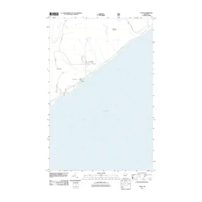
2011 Map of Tofte
USGS Topo · Published 2011About this map
Tofte occupies a narrow shelf of land between the high ridges of the Sawtooth Mountains and the vast expanse of Lake Superior. This 2011 survey illustrates how human activity follows the contours of the North Shore, with State Hwy 61 serving as the primary corridor connecting the shoreline community. Local infrastructure includes the Tofte Post Office and the Tofte Cemetery, while aviation needs are met by the Grevais Landing Field and Tofte Airport just inland from the coast.
Find a feature on this map
20 named features on this map. Tap any name to fly to it.
Don’t see what you’re looking for? This feature index may not catch every label — zoom into the map to look around manually.
Map Details
Editions of this 2011 Tofte Map
This is the sole edition of this map. No revisions or reprints were ever made.
Other maps of this area

1919 · Lutsen
USGS Topo · 1:62,500

1954 · Two Harbors
USGS Topo · 1:250,000

1955 · Tofte
USGS Topo · 1:24,000

1955 · Schroeder
USGS Topo · 1:24,000

1955 · Tofte
USGS Topo · 1:62,500

1957 · Two Harbors
USGS Topo · 1:250,000

1958 · Two Harbors
USGS Topo · 1:250,000

1959 · Lutsen
USGS Topo · 1:24,000

1964 · Two Harbors
USGS Topo · 1:250,000
1977 · Grand Marais
USGS Topo · 1:100,000