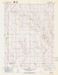
1979 Map of Togo
USGS Topo · Published 1979About this map
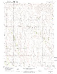
Oil Field operations dominate the landscape of south-central Kansas in this late-1970s survey. The area is characterized by a dense network of petroleum extraction sites, with numerous Oil Well and Oil Wells markings scattered across the terrain. At the heart of this rural setting is the small settlement of Togo, located near the Prairie Home Ch. The landscape is drained by Chalk Creek and Happy Creek, which cut through the open country. These drainages provide a natural contrast to the industrial footprint of the energy sector, which includes a local Quarry and a prominent Radio Tower. The map also captures the political boundary between Graham Co and Trego Co, illustrating how these administrative lines intersect with the region's natural and economic geography during a peak era of local oil production.
Find a feature on this map
15 named features on this map. Tap any name to fly to it.
Don’t see what you’re looking for? This feature index may not catch every label — zoom into the map to look around manually.
Map Details
Editions of this 1979 Togo Map
This is the sole edition of this map. No revisions or reprints were ever made.
Other maps of this area

1893 · Hill
USGS Topo · 1:125,000

1955 · Beloit
USGS Topo · 1:250,000

1959 · Beloit
USGS Topo · 1:250,000
1962 · Wa Keeney East
USGS Topo · 1:24,000
1963 · Wa Keeney West
USGS Topo · 1:24,000
1963 · Hill City 4 SW
USGS Topo · 1:24,000

1979 · Bogue
USGS Topo · 1:24,000

1979 · Hill City South
USGS Topo · 1:24,000

1979 · Penokee
USGS Topo · 1:24,000
1979 · Hay Hollow
USGS Topo · 1:24,000