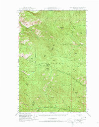
1948 Map of Togo Mountain
USGS Topo · Published 1973About this map
Colville National Forest dominates this mid-century survey of the high country in Ferry County, where the landscape is defined by a dense network of drainages and named peaks. The terrain is organized by prominent ridges like Huckleberry Ridge and Boulder Ridge, with water flowing through numerous forks of the Deer Cr and Togo Cr systems. Evidence of Forest Service administration and early settlement is found at the Summit Guard Sta and the Ryan Cabin, which sits near Ryan Hill in the southwestern quadrant.
Find a feature on this map
63 named features on this map. Tap any name to fly to it.
Don’t see what you’re looking for? This feature index may not catch every label — zoom into the map to look around manually.
Map Details
Editions of this 1948 Togo Mountain Map
2 editions found
Other maps of this area

1904 · Republic
USGS Topo · 1:125,000

1936 · Marcus
USGS Topo · 1:96,000

1942 · Marcus
USGS Topo · 1:125,000

1948 · Curlew
USGS Topo · 1:62,500

1948 · Republic
USGS Topo · 1:62,500

1948 · Sherman Peak
USGS Topo · 1:62,500

1948 · Kettle Falls
USGS Topo · 1:62,500

1948 · Orient
USGS Topo · 1:62,500

1948 · Togo Mountain
USGS Topo · 1:62,500

1951 · Togo Mountain
USGS Topo · 1:62,500