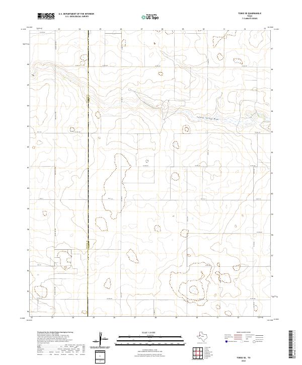
2022 Map of Tokio SE
USGS Topo · Published 2022About this map
The high plains along the boundary of Yoakum and Terry counties are defined by a rhythmic grid of rural roads and the meandering path of Sulphur Springs Draw. This landscape shows the characteristic agricultural organization of West Texas, where local travel is facilitated by a network of ranch and farm-to-market roads. Significant north-south corridors like Ranch Rd 1780 and Co Rd 121 slice through the level terrain, connecting remote farmsteads and ranches. The topography is predominantly flat, save for the subtle depression of the draw which provides a natural break in the geometric surveying of the land. Key east-west routes such as Fm 213 E and Fm 330 further delineate the territory, showing the modern infrastructure required to manage these expansive ranching and farming operations near the border of the two counties.
Find a feature on this map
23 named features on this map. Tap any name to fly to it.
Don’t see what you’re looking for? This feature index may not catch every label — zoom into the map to look around manually.
Map Details
Editions of this 2022 Tokio SE Map
This is the sole edition of this map. No revisions or reprints were ever made.
Other maps of this area

1954 · Hobbs
USGS Topo · 1:250,000

1954 · Brownfield
USGS Topo · 1:250,000

1958 · Brownfield
USGS Topo · 1:250,000

1958 · Hobbs
USGS Topo · 1:250,000

1962 · Brownfield
USGS Topo · 1:250,000

1969 · Gomez
USGS Topo · 1:24,000

1969 · Loop
USGS Topo · 1:24,000

1969 · Wellman
USGS Topo · 1:24,000

1970 · Seagraves
USGS Topo · 1:24,000

1970 · Tokio
USGS Topo · 1:24,000