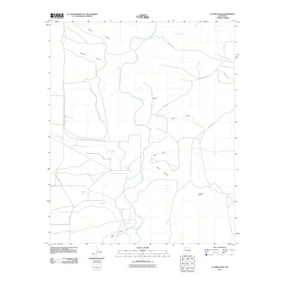
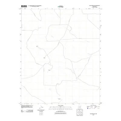
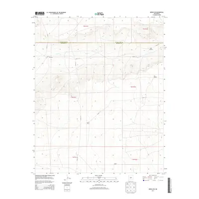
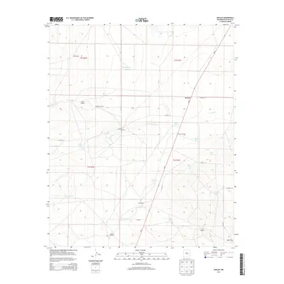
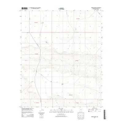
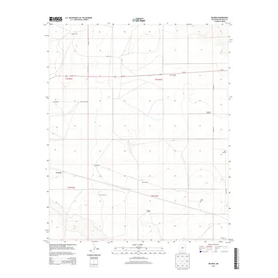
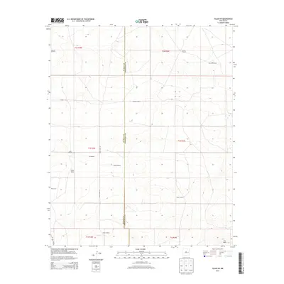
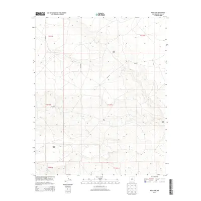
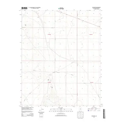
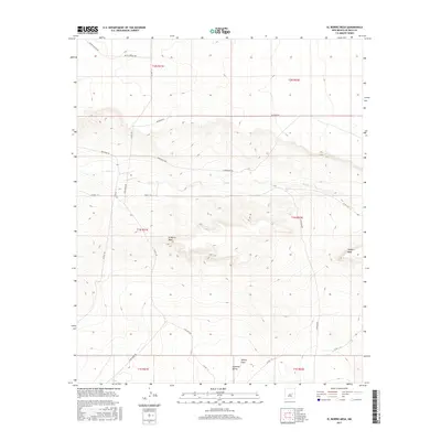
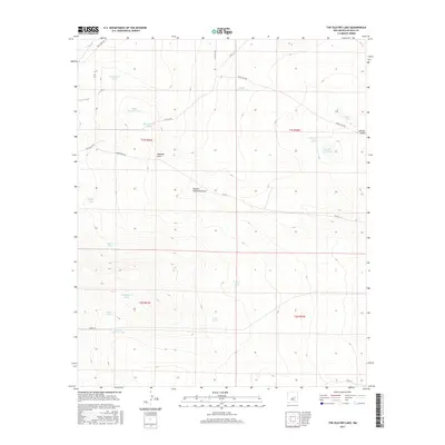
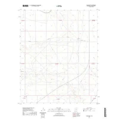
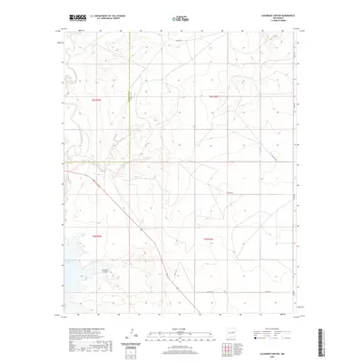
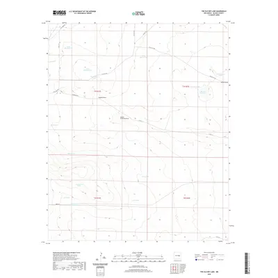
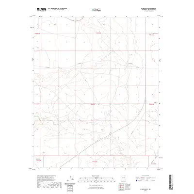
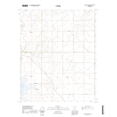
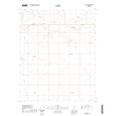
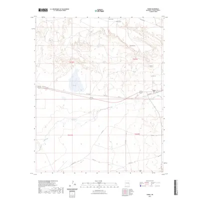
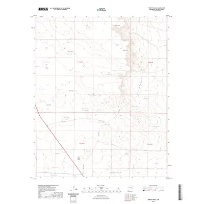
1973 Map of Tolar SW
USGS Topo · Published 1987About this map
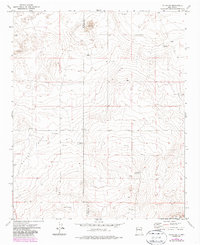
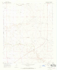
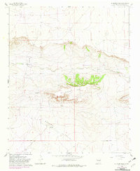
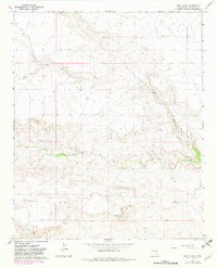
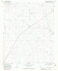
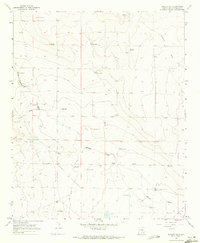
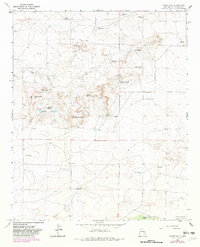
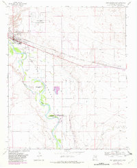
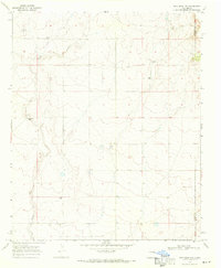
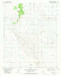
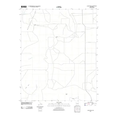
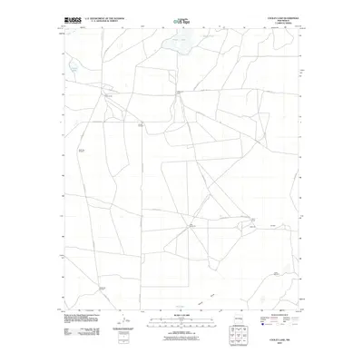
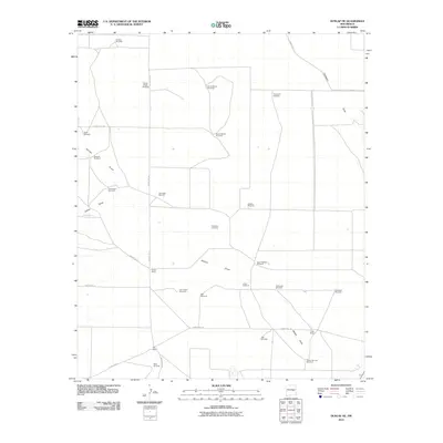
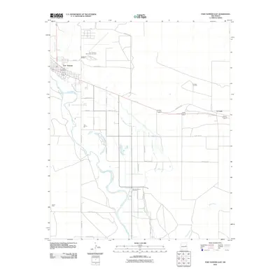
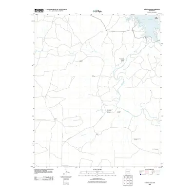
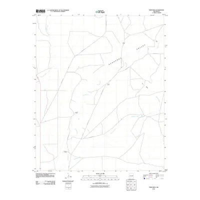
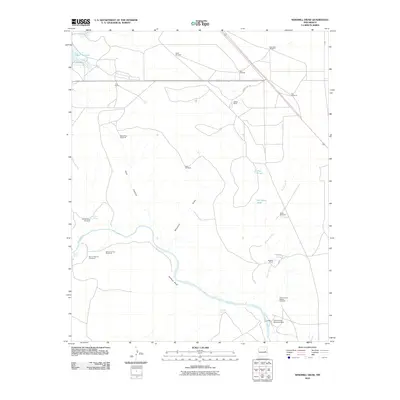
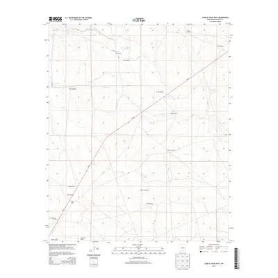
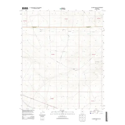
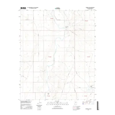
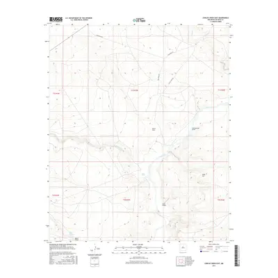
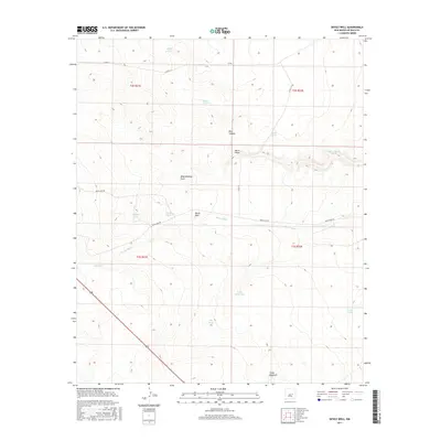
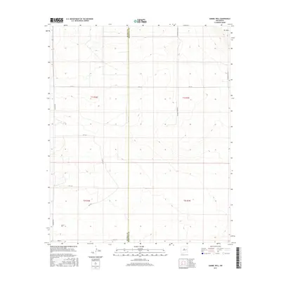
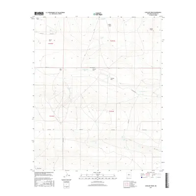
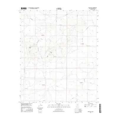
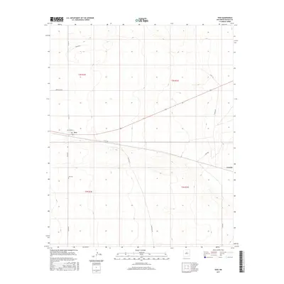
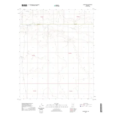
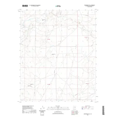
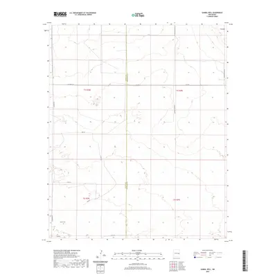
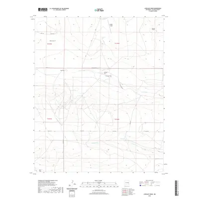
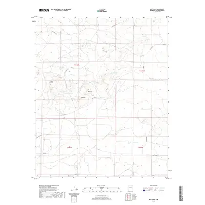
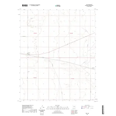
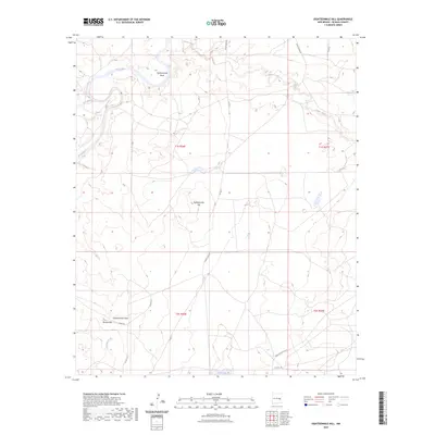
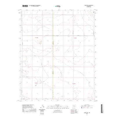
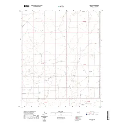
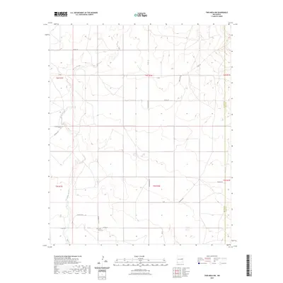
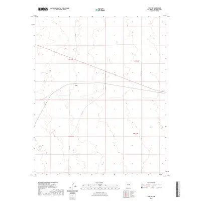
White Mesa dominates the southwestern quadrant of this eastern New Mexico landscape, a high tableland punctuated by family-named water sources and small burial sites. The presence of Blanco Cem and another uncaptioned Cem near the mesa's edge provides valuable evidence for genealogists researching early settlement families in this part of De Baca and Roosevelt counties. Water security was the defining factor of life here, as evidenced by a network of windmills and wells such as Fletcher Windmill, Fry Windmill, and White Well.
Find a feature on this map
22 named features on this map. Tap any name to fly to it.
Don’t see what you’re looking for? This feature index may not catch every label — zoom into the map to look around manually.
Map Details
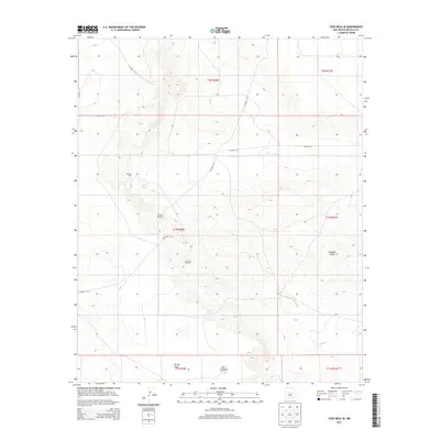
Editions of this 1973 Tolar SW Map
2 editions found
Historical Maps of Roosevelt County Through Time
222 maps found
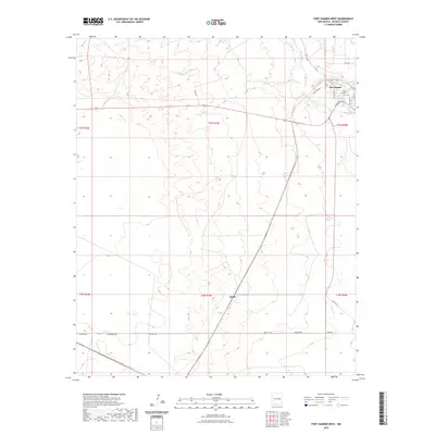
1965 Fort Sumner West
De Baca County, NM
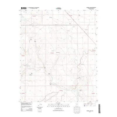
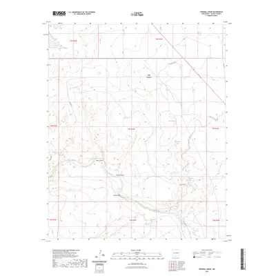
1965 Windmill Draw
De Baca County, NM
1966 Alamo Ranch
De Baca County, NM
1966 Borica SW
De Baca County, NM
1966 Colorado Canyon
De Baca County, NM
1966 Cooper Ranch
De Baca County, NM
1966 El Morro Mesa
De Baca County, NM
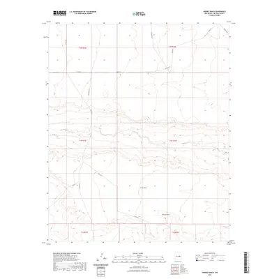
1966 Horney Ranch
De Baca County, NM
1966 Ricardo
De Baca County, NM
1966 Sumner Dam
De Baca County, NM
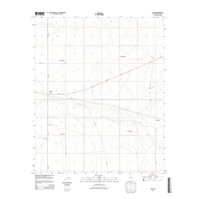
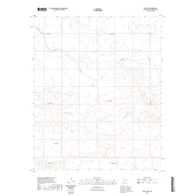
1966 West Camp
De Baca County, NM
1966 Yeso
De Baca County, NM
1966 Yeso NW
De Baca County, NM
1967 Conejo Creek East
De Baca County, NM
1967 Conejo Creek West
De Baca County, NM
1967 Cooley Lake
De Baca County, NM
1967 Devils Well
De Baca County, NM
1967 Dunlap
De Baca County, NM
1967 Dunlap NE
De Baca County, NM
1967 Eighteenmile Hill
De Baca County, NM
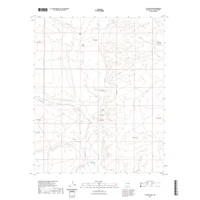
1967 La Espia Peak
De Baca County, NM

1967 Lovelady Draw
De Baca County, NM
1967 The Old Dry Lake
De Baca County, NM
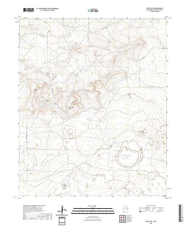
1967 Watts Hill
De Baca County, NM
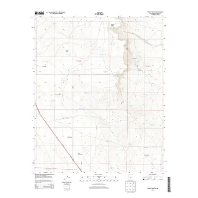
1967 Wright Ranch
De Baca County, NM
1968 Bonner Lake
De Baca County, NM
1968 Candy Mesa
De Baca County, NM
1968 Fort Sumner East
De Baca County, NM
1968 Lomas Gatos
De Baca County, NM
1968 Taiban
De Baca County, NM
1968 Twin Mesa
De Baca County, NM
1968 Twin Mesa NW
De Baca County, NM
1973 Gammil Well
De Baca County, NM
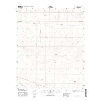
1973 Tolar SW
De Baca County, NM
1978 El Morro Ranch SE
De Baca County, NM
1981 Yeso Mesa
De Baca County, NM
1981 Yeso Mesa SE
De Baca County, NM
2010 Alamo Ranch
De Baca County, NM
2010 Bonner Lake
De Baca County, NM
2010 Borica SW
De Baca County, NM
2010 Candy Mesa
De Baca County, NM
2010 Colorado Canyon
De Baca County, NM
2010 Conejo Creek East
De Baca County, NM
2010 Conejo Creek West
De Baca County, NM
2010 Cooley Lake
De Baca County, NM
2010 Cooper Ranch
De Baca County, NM
2010 Devils Well
De Baca County, NM
2010 Dunlap
De Baca County, NM
2010 Dunlap NE
De Baca County, NM
2010 Eighteenmile Hill
De Baca County, NM
2010 El Morro Mesa
De Baca County, NM
2010 El Morro Ranch SE
De Baca County, NM
2010 Fort Sumner East
De Baca County, NM
2010 Fort Sumner West
De Baca County, NM
2010 Gammil Well
De Baca County, NM
2010 Horney Ranch
De Baca County, NM
2010 La Espia Peak
De Baca County, NM
2010 Lomas Gatos
De Baca County, NM
2010 Lovelady Draw
De Baca County, NM
2010 Ricardo
De Baca County, NM
2010 Sumner Dam
De Baca County, NM
2010 Taiban
De Baca County, NM
2010 The Old Dry Lake
De Baca County, NM
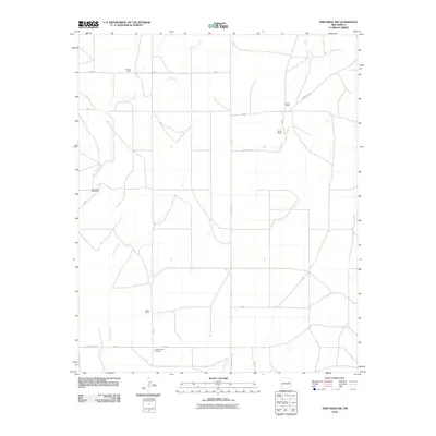
2010 Tolar SW
De Baca County, NM
2010 Twin Mesa
De Baca County, NM
2010 Twin Mesa NW
De Baca County, NM
2010 Watts Hill
De Baca County, NM
2010 West Camp
De Baca County, NM
2010 Windmill Draw
De Baca County, NM
2010 Wright Ranch
De Baca County, NM
2010 Yeso
De Baca County, NM
2010 Yeso Mesa
De Baca County, NM
2010 Yeso Mesa SE
De Baca County, NM
2010 Yeso NW
De Baca County, NM
2013 Alamo Ranch
De Baca County, NM
2013 Bonner Lake
De Baca County, NM
2013 Borica SW
De Baca County, NM
2013 Candy Mesa
De Baca County, NM
2013 Colorado Canyon
De Baca County, NM
2013 Conejo Creek East
De Baca County, NM
2013 Conejo Creek West
De Baca County, NM
2013 Cooley Lake
De Baca County, NM
2013 Cooper Ranch
De Baca County, NM
2013 Devils Well
De Baca County, NM
2013 Dunlap
De Baca County, NM
2013 Dunlap NE
De Baca County, NM
2013 Eighteenmile Hill
De Baca County, NM
2013 El Morro Mesa
De Baca County, NM
2013 El Morro Ranch SE
De Baca County, NM
2013 Fort Sumner East
De Baca County, NM
2013 Fort Sumner West
De Baca County, NM
2013 Gammil Well
De Baca County, NM
2013 Horney Ranch
De Baca County, NM
2013 La Espia Peak
De Baca County, NM
2013 Lomas Gatos
De Baca County, NM
2013 Lovelady Draw
De Baca County, NM
2013 Ricardo
De Baca County, NM
2013 Sumner Dam
De Baca County, NM
2013 Taiban
De Baca County, NM
2013 The Old Dry Lake
De Baca County, NM
2013 Tolar SW
De Baca County, NM
2013 Twin Mesa
De Baca County, NM
2013 Twin Mesa NW
De Baca County, NM
2013 Watts Hill
De Baca County, NM
2013 West Camp
De Baca County, NM
2013 Windmill Draw
De Baca County, NM
2013 Wright Ranch
De Baca County, NM
2013 Yeso
De Baca County, NM
2013 Yeso Mesa
De Baca County, NM
2013 Yeso Mesa SE
De Baca County, NM
2013 Yeso NW
De Baca County, NM
2017 Alamo Ranch
De Baca County, NM
2017 Bonner Lake
De Baca County, NM
2017 Borica SW
De Baca County, NM
2017 Candy Mesa
De Baca County, NM
2017 Colorado Canyon
De Baca County, NM
2017 Conejo Creek East
De Baca County, NM
2017 Conejo Creek West
De Baca County, NM
2017 Cooley Lake
De Baca County, NM
2017 Cooper Ranch
De Baca County, NM
2017 Devils Well
De Baca County, NM
2017 Dunlap
De Baca County, NM
2017 Dunlap NE
De Baca County, NM
2017 Eighteenmile Hill
De Baca County, NM
2017 El Morro Mesa
De Baca County, NM
2017 El Morro Ranch SE
De Baca County, NM
2017 Fort Sumner East
De Baca County, NM
2017 Fort Sumner West
De Baca County, NM
2017 Gammil Well
De Baca County, NM
2017 Horney Ranch
De Baca County, NM
2017 La Espia Peak
De Baca County, NM
2017 Lomas Gatos
De Baca County, NM
2017 Lovelady Draw
De Baca County, NM
2017 Ricardo
De Baca County, NM
2017 Sumner Dam
De Baca County, NM
2017 Taiban
De Baca County, NM
2017 The Old Dry Lake
De Baca County, NM
2017 Tolar SW
De Baca County, NM
2017 Twin Mesa
De Baca County, NM
2017 Twin Mesa NW
De Baca County, NM
2017 Watts Hill
De Baca County, NM
2017 West Camp
De Baca County, NM
2017 Windmill Draw
De Baca County, NM
2017 Wright Ranch
De Baca County, NM
2017 Yeso
De Baca County, NM
2017 Yeso Mesa
De Baca County, NM
2017 Yeso Mesa SE
De Baca County, NM
2017 Yeso NW
De Baca County, NM
2020 Alamo Ranch
De Baca County, NM
2020 Bonner Lake
De Baca County, NM
2020 Borica SW
De Baca County, NM
2020 Candy Mesa
De Baca County, NM
2020 Colorado Canyon
De Baca County, NM
2020 Conejo Creek East
De Baca County, NM
2020 Conejo Creek West
De Baca County, NM
2020 Cooley Lake
De Baca County, NM
2020 Cooper Ranch
De Baca County, NM
2020 Devils Well
De Baca County, NM
2020 Dunlap
De Baca County, NM
2020 Dunlap NE
De Baca County, NM
2020 Eighteenmile Hill
De Baca County, NM
2020 El Morro Mesa
De Baca County, NM
2020 El Morro Ranch SE
De Baca County, NM

2020 Fort Sumner East
De Baca County, NM
2020 Fort Sumner West
De Baca County, NM
2020 Gammil Well
De Baca County, NM
2020 Horney Ranch
De Baca County, NM
2020 La Espia Peak
De Baca County, NM
2020 Lomas Gatos
De Baca County, NM
2020 Lovelady Draw
De Baca County, NM
2020 Ricardo
De Baca County, NM
2020 Sumner Dam
De Baca County, NM
2020 Taiban
De Baca County, NM
2020 The Old Dry Lake
De Baca County, NM
2020 Tolar SW
De Baca County, NM
2020 Twin Mesa
De Baca County, NM
2020 Twin Mesa NW
De Baca County, NM
2020 Watts Hill
De Baca County, NM
2020 West Camp
De Baca County, NM
2020 Windmill Draw
De Baca County, NM
2020 Wright Ranch
De Baca County, NM
2020 Yeso
De Baca County, NM
2020 Yeso Mesa
De Baca County, NM
2020 Yeso Mesa SE
De Baca County, NM
2020 Yeso NW
De Baca County, NM
2023 Alamo Ranch
De Baca County, NM
2023 Bonner Lake
De Baca County, NM
2023 Borica SW
De Baca County, NM
2023 Candy Mesa
De Baca County, NM
2023 Colorado Canyon
De Baca County, NM
2023 Conejo Creek East
De Baca County, NM
2023 Conejo Creek West
De Baca County, NM
2023 Cooley Lake
De Baca County, NM
2023 Cooper Ranch
De Baca County, NM
2023 Devils Well
De Baca County, NM
2023 Dunlap
De Baca County, NM
2023 Dunlap NE
De Baca County, NM
2023 Eighteenmile Hill
De Baca County, NM
2023 El Morro Mesa
De Baca County, NM
2023 El Morro Ranch SE
De Baca County, NM
2023 Fort Sumner East
De Baca County, NM
2023 Fort Sumner West
De Baca County, NM
2023 Gammil Well
De Baca County, NM
2023 Horney Ranch
De Baca County, NM
2023 La Espia Peak
De Baca County, NM
2023 Lomas Gatos
De Baca County, NM
2023 Lovelady Draw
De Baca County, NM
2023 Ricardo
De Baca County, NM
2023 Sumner Dam
De Baca County, NM
2023 Taiban
De Baca County, NM
2023 The Old Dry Lake
De Baca County, NM
2023 Tolar SW
De Baca County, NM
2023 Twin Mesa
De Baca County, NM
2023 Twin Mesa NW
De Baca County, NM
2023 Watts Hill
De Baca County, NM
2023 West Camp
De Baca County, NM
2023 Windmill Draw
De Baca County, NM
2023 Wright Ranch
De Baca County, NM
2023 Yeso
De Baca County, NM
2023 Yeso Mesa
De Baca County, NM
2023 Yeso Mesa SE
De Baca County, NM
2023 Yeso NW
De Baca County, NM