
1938 Map of Toledo
USGS Topo · Published 1938About this map
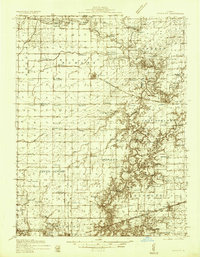
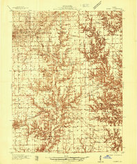
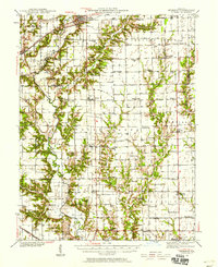
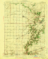
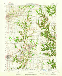
Lincoln Log Cabin State Park serves as a central landmark in this 1930s landscape, situated just south of Charleston near the winding course of the Embarrass River. The terrain is defined by the river's numerous crossings and distinct bends, including Sconce Bend and a series of historical fords such as Walker Ford, Rocky Ford, and Bowman Ford. This network of river access points suggests an era of local travel still deeply connected to natural topography and seasonal water levels.
Find a feature on this map
126 named features on this map. Tap any name to fly to it.
Don’t see what you’re looking for? This feature index may not catch every label — zoom into the map to look around manually.
Map Details
Editions of this 1938 Toledo Map
This is the sole edition of this map. No revisions or reprints were ever made.
Other maps of this area

1933 · Toledo
USGS Topo · 1:62,500

1934 · Mattoon
USGS Topo · 1:62,500

1935 · Arcola
USGS Topo · 1:48,000
1936 · Oakland
USGS Topo · 1:48,000
1936 · Casey
USGS Topo · 1:48,000

1937 · Mattoon
USGS Topo · 1:62,500

1940 · Arcola
USGS Topo · 1:62,500
1940 · Greenup
USGS Topo · 1:62,500
1942 · Oakland
USGS Topo · 1:62,500
1942 · Casey
USGS Topo · 1:62,500