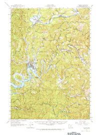
1957 Map of Toledo
USGS Topo · Published 1966About this map
The Yaquina River and its winding tributaries dominate this mid-century survey of Lincoln County, where the timber industry and rail transport shaped the coastal landscape. Toledo sits as a central hub at the confluence of the river and Depot Slough, served by the Southern Pacific Railroad. Further north, the Siletz River passes near Siletz and the Riverside Cem, while industrial sites like Camp Twelve and various unnamed mills indicate the intensive logging of the era. The presence of several Covered Bridges, including the named Orton Bridge (Covered) near Logsden, highlights the engineering of the local road network before modern highway replacements. Significant landmarks for local history include the Cannon School, Baber Lookout, and the high point at Pioneer Summit overlooking the Siuslaw National Forest.
Find a feature on this map
85 named features on this map. Tap any name to fly to it.
Don’t see what you’re looking for? This feature index may not catch every label — zoom into the map to look around manually.
Map Details
Editions of this 1957 Toledo Map
2 editions found
Other maps of this area

1922 · Waldport
USGS Topo · 1:62,500

1939 · Marys Peak
USGS Topo · 1:62,500

1941 · Cape Foulweather
USGS Topo · 1:62,500

1942 · Euchre Mtn
USGS Topo · 1:62,500

1942 · Marys Peak
USGS Topo · 1:62,500

1942 · Alsea
USGS Topo · 1:62,500

1942 · Waldport
USGS Topo · 1:62,500

1942 · Yaquina
USGS Topo · 1:62,500

1942 · Valsetz
USGS Topo · 1:62,500

1942 · Tidewater
USGS Topo · 1:62,500