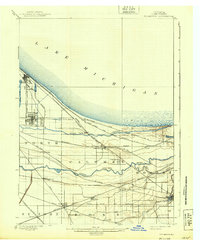
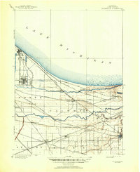
1900 Map of Tolleston
USGS Topo · Published 1939About this map
Lake Michigan dominates the northern shoreline of this survey, where a massive concentration of rail infrastructure defines the burgeoning industrial character of Lake County. The landscape is a complex network of waterways and steel, anchored by the Grand Calumet River and Little Calumet River. These rivers run parallel to the coast, creating a distinct corridor for major trunk lines including the Baltimore and Ohio R. R. and the Pittsburg Fort Wayne and Chicago R. R..
Find a feature on this map
46 named features on this map. Tap any name to fly to it.
Don’t see what you’re looking for? This feature index may not catch every label — zoom into the map to look around manually.
Map Details
Editions of this 1900 Tolleston Map
6 editions found
Other maps of this area

1889 · Chicago
USGS Topo · 1:62,500

1891 · Chicago
USGS Topo · 1:62,500

1892 · Calumet
USGS Topo · 1:62,500

1893 · Calumet
USGS Topo · 1:62,500

1900 · Chicago
USGS Topo · 1:62,500

1900 · Toleston
USGS Topo · 1:62,500

1900 · Calumet
USGS Topo · 1:62,500

1901 · Calumet
USGS Topo · 1:62,500

1901 · Chicago
USGS Topo · 1:62,500

1929 · Calumet Lake
USGS Topo · 1:24,000