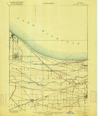
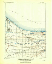
1900 Map of Toleston
USGS Topo · Published 1916About this map
Lake Michigan dominates the northern horizon of this 1897 survey, where a complex network of industrial and transport infrastructure was rapidly reshaping the Calumet region. The landscape is defined by the parallel paths of the Grand Calumet River and Little Calumet River, which wind between growing urban centers like Whiting and East Chicago. A remarkable concentration of rail lines, including the Baltimore and Ohio R. R. and the Elgin Joliet and Eastern R. R., crisscross the marshy terrain, converging at junctions like Griffith.
Find a feature on this map
40 named features on this map. Tap any name to fly to it.
Don’t see what you’re looking for? This feature index may not catch every label — zoom into the map to look around manually.
Map Details
Editions of this 1900 Toleston Map
6 editions found
Other maps of this area

1889 · Chicago
USGS Topo · 1:62,500

1891 · Chicago
USGS Topo · 1:62,500

1892 · Calumet
USGS Topo · 1:62,500

1893 · Calumet
USGS Topo · 1:62,500

1900 · Chicago
USGS Topo · 1:62,500

1900 · Toleston
USGS Topo · 1:62,500

1900 · Calumet
USGS Topo · 1:62,500

1901 · Calumet
USGS Topo · 1:62,500

1901 · Chicago
USGS Topo · 1:62,500

1929 · Calumet Lake
USGS Topo · 1:24,000