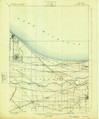
1900 Map of Toleston
USGS Topo · Published 1925About this map
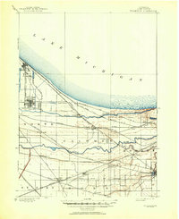
Lake Michigan dominates the northern horizon of this industrializing landscape, where the sandy shoreline of northwest Indiana met the rapid expansion of late 19th-century infrastructure. The region is defined by a dense lattice of steel, as major lines like the Baltimore and Ohio R. R. and Elgin Joliet and Eastern R. R. converge on the emerging hubs of Whiting and East Chicago. Between the industrial waterfront and the southern marshes, the Grand Calumet River and Little Calumet River snake through a terrain punctuated by early settlements such as Toleston, Hessville, and Griffith. Geographer Jno. H. Renshawe helped oversee this survey, which documents the area before the heavy 20th-century urban fill altered the natural wetlands near Lake George and Bear Lake. The map reveals the intricate connection between early rail commerce and the distinctive hydrology of the Calumet region, including Hart Ditch and Deep River.
Find a feature on this map
39 named features on this map. Tap any name to fly to it.
Don’t see what you’re looking for? This feature index may not catch every label — zoom into the map to look around manually.
Map Details
Editions of this 1900 Toleston Map
6 editions found
Other maps of this area

1889 · Chicago
USGS Topo · 1:62,500

1891 · Chicago
USGS Topo · 1:62,500

1892 · Calumet
USGS Topo · 1:62,500

1893 · Calumet
USGS Topo · 1:62,500

1900 · Chicago
USGS Topo · 1:62,500

1900 · Toleston
USGS Topo · 1:62,500

1900 · Calumet
USGS Topo · 1:62,500

1901 · Calumet
USGS Topo · 1:62,500

1901 · Chicago
USGS Topo · 1:62,500

1929 · Calumet Lake
USGS Topo · 1:24,000