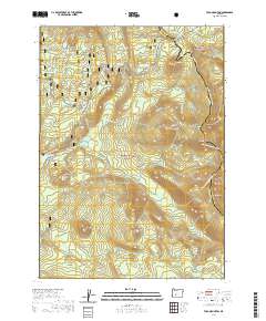
2020 Map of Tolo Mountain
USGS Topo · Published 2020About this map
Windigo Pass serves as a critical high-elevation crossing in this high-country landscape, where the Cascade Range forms the divide between Umpqua National Forest and Deschutes National Forest. The 2020 survey reveals an intricate network of water and trail systems, notably the Pacific Crest National Scenic Trail as it skirts Tolo Mtn and Mule Peak. This region is defined by its volcanic geology and alpine hydrology, featuring landforms like Red Cinder Butte and the headwaters of the North Umpqua River. The map documents numerous remote water bodies, from the cluster of Calamut Lake and Lake Charline in the northwest to Maidu Lake near the southern boundary. Designated conservation areas, including the Little Deschutes Wild and Scenic River, highlight the protected status of these mountain watersheds.
Find a feature on this map
41 named features on this map. Tap any name to fly to it.
Don’t see what you’re looking for? This feature index may not catch every label — zoom into the map to look around manually.
Map Details
Editions of this 2020 Tolo Mountain Map
This is the sole edition of this map. No revisions or reprints were ever made.
Other maps of this area

1917 · Diamond Lake
USGS Topo · 1:125,000

1935 · Chemult
USGS Topo · 1:96,000

1941 · Chemult
USGS Topo · 1:125,000

1955 · Crescent
USGS Topo · 1:250,000

1956 · Diamond Lake
USGS Topo · 1:62,500

1956 · Summit Lake
USGS Topo · 1:62,500

1957 · Crescent
USGS Topo · 1:250,000

1958 · Crescent
USGS Topo · 1:250,000

1958 · Roseburg
USGS Topo · 1:250,000

1959 · Roseburg
USGS Topo · 1:250,000