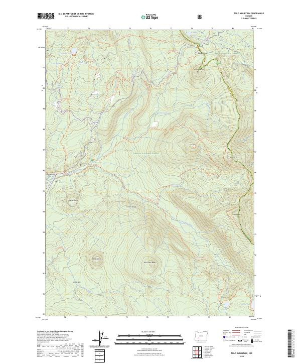
2024 Map of Tolo Mountain
USGS Topo · Published 2024About this map
The Mount Thielsen Wilderness and Umpqua National Forest define this high-elevation landscape along the border of Douglas and Klamath counties. Centered on the rugged spine of the Cascade Range, the map details a complex network of backcountry routes, most notably the Pacific Crest National Scenic Trl as it winds north toward Windigo Pass. The headwaters of the North Umpqua River emerge here, flanked by volcanic features such as Windigo Butte and Red Cinder Butte.
Find a feature on this map
48 named features on this map. Tap any name to fly to it.
Don’t see what you’re looking for? This feature index may not catch every label — zoom into the map to look around manually.
Map Details
Editions of this 2024 Tolo Mountain Map
This is the sole edition of this map. No revisions or reprints were ever made.
Other maps of this area

1917 · Diamond Lake
USGS Topo · 1:125,000

1935 · Chemult
USGS Topo · 1:96,000

1941 · Chemult
USGS Topo · 1:125,000

1955 · Crescent
USGS Topo · 1:250,000

1956 · Diamond Lake
USGS Topo · 1:62,500

1956 · Summit Lake
USGS Topo · 1:62,500

1957 · Crescent
USGS Topo · 1:250,000

1958 · Crescent
USGS Topo · 1:250,000

1958 · Roseburg
USGS Topo · 1:250,000

1959 · Roseburg
USGS Topo · 1:250,000