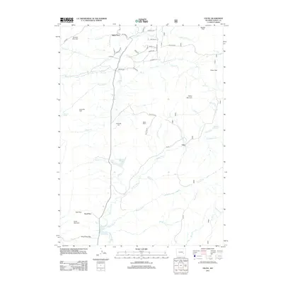
2012 Map of Toltec
USGS Topo · Published 2012About this map
N Laramie River winds through this high-altitude landscape of southern Wyoming, anchoring a network of remote ranching outposts and high-country passes. The small settlement of Toltec sits at the intersection of several forest routes, serving as a landmark in a terrain defined by dramatic elevation changes. To the north, Squaw Place marks a historic node along Fetterman Rd, a route that carries significant military and frontier history through the region.
Find a feature on this map
56 named features on this map. Tap any name to fly to it.
Don’t see what you’re looking for? This feature index may not catch every label — zoom into the map to look around manually.
Map Details
Editions of this 2012 Toltec Map
This is the sole edition of this map. No revisions or reprints were ever made.
Other maps of this area

1954 · Torrington
USGS Topo · 1:250,000

1958 · Torrington
USGS Topo · 1:250,000

1964 · Toltec
USGS Topo · 1:24,000

1964 · School Section Mountain
USGS Topo · 1:24,000

1964 · Saddleback Mountain
USGS Topo · 1:24,000

1964 · Windy Peak
USGS Topo · 1:24,000

1964 · Marshall
USGS Topo · 1:24,000
1964 · Warbonnet Peak
USGS Topo · 1:24,000

1968 · Cow Creek Mountain
USGS Topo · 1:24,000

1968 · Cottonwood Creek
USGS Topo · 1:24,000