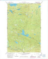
1959 Map of Tom Lake
USGS Topo · Published 1986About this map
Grand Portage State Forest and the Superior National Forest converge in this 1959 survey of northeastern Cook County, showing a landscape defined by its complex hydrology and timber heritage. The sheet is anchored by Tom Lake at its center, with the Brule River and Flute Reed River winding through the southern terrain within Judge C. R. Magney State Park. The high point of the quadrangle is marked by the Devilfish Lookout Tower, overlooking a network of smaller water bodies including Esther Lake, Chester Lake, and Moosehorn Lake. This mapping captures the region before extensive modern development, detailing the remote portages and creeks like Portage Brook and Beaverdam Creek that historically facilitated movement through these North Shore uplands. Several gravel pits suggest localized industrial activity amidst the state and national protected lands.
Find a feature on this map
21 named features on this map. Tap any name to fly to it.
Don’t see what you’re looking for? This feature index may not catch every label — zoom into the map to look around manually.
Map Details
Editions of this 1959 Tom Lake Map
3 editions found
Other maps of this area

1954 · Two Harbors
USGS Topo · 1:250,000

1957 · Two Harbors
USGS Topo · 1:250,000

1957 · Quetico
USGS Topo · 1:250,000

1958 · Two Harbors
USGS Topo · 1:250,000

1958 · Hancock
USGS Topo · 1:250,000

1959 · Northern Light Lake
USGS Topo · 1:24,000

1959 · Pine Lake East
USGS Topo · 1:24,000

1959 · Tom Lake
USGS Topo · 1:24,000

1959 · Pine Lake West
USGS Topo · 1:24,000

1959 · Fort William
USGS Topo · 1:250,000