
1976 Map of Tomah NE
USGS Topo · Published 1978About this map
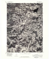
Tomah anchors the northeastern corner of this 1976 orthophotograph, a year when the city's residential and industrial expansion was clearly etched into the Wisconsin landscape. The bird's-eye view provided by this survey, derived from imagery taken by the U.S. Geological Survey and the Wisconsin Geological and Natural History Survey, reveals the distinct contrast between the urban grid surrounding Lake Tomah and the vast agricultural patterns to the south. In the southern portion of the quadrangle, the small settlement of Ridgeville serves as a landmark amidst a complex network of contour-plowed fields and woodlots. This visual record captures the transition of rural Monroe County during the mid-1970s, documenting how transportation corridors began to bisect traditional farmsteads and influence the growth of regional hubs.
Find a feature on this map
3 named features on this map. Tap any name to fly to it.
Don’t see what you’re looking for? This feature index may not catch every label — zoom into the map to look around manually.
Map Details
Editions of this 1976 Tomah NE Map
2 editions found
Other maps of this area

1916 · Tomah
USGS Topo · 1:62,500

1919 · Kendall
USGS Topo · 1:62,500

1921 · Kendall
USGS Topo · 1:62,500

1947 · Millston
USGS Topo · 1:62,500

1949 · Millston
USGS Topo · 1:62,500

1949 · Tomah
USGS Topo · 1:62,500

1953 · Eau Claire
USGS Topo · 1:250,000

1958 · Eau Claire
USGS Topo · 1:250,000

1958 · Wyeville
USGS Topo · 1:48,000

1958 · La Crosse
USGS Topo · 1:250,000