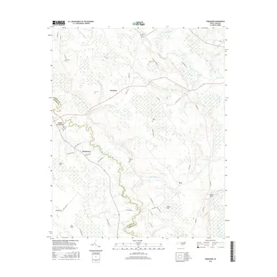
2016 Map of Tomahawk
USGS Topo · Published 2016About this map
Tomahawk and Murphytown anchor this rural landscape in the 21st century, where the serpentine course of the Black River and South River define the boundaries between Sampson and Bladen counties. This coastal plain region is characterized by unique elliptical depressions known as Carolina bays, including Dismal Bay, Keith Bay, and Sloans Bay, which dominate the hydrology alongside numerous creeks like Cooter Creek and Enoch Mill Cr. For those researching local lineages, the map identifies several family-associated burial sites such as Herring Cem, Baylam Cem, and Newton Cem. The landscape reveals a network of local roads including Clear Run School Rd and Ennis Bridge Rd, providing access to distinct natural features like the prominent Bloody Bluff and the low-lying Pridgen Flats.
Find a feature on this map
67 named features on this map. Tap any name to fly to it.
Don’t see what you’re looking for? This feature index may not catch every label — zoom into the map to look around manually.
Map Details
Editions of this 2016 Tomahawk Map
This is the sole edition of this map. No revisions or reprints were ever made.
Other maps of this area

1953 · Florence
USGS Topo · 1:250,000

1954 · Florence
USGS Topo · 1:250,000

1954 · White Lake
USGS Topo · 1:62,500

1955 · Atkinson
USGS Topo · 1:62,500

1959 · Garland
USGS Topo · 1:62,500

1962 · Rose Hill
USGS Topo · 1:62,500

1982 · Elizabethtown
USGS Topo · 1:100,000
1984 · Harrells
USGS Topo · 1:24,000
1984 · Delway
USGS Topo · 1:24,000
1984 · Atkinson
USGS Topo · 1:24,000