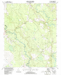
1986 Map of Tomahawk
USGS Topo · Published 1986About this map
Tomahawk serves as a central hub in this mid-1980s landscape where the South River and Black River define the local geography. The area is marked by a unique hydrological pattern of elliptical bays, such as Dismal Bay, Gingerberry Bay, and Sloans Bay, which are visible through aerial photography. This rural coastal plain environment is dotted with small river landings like Jackie Landing and Delta Landing, hinting at the historical importance of these waterways for transport and trade.
Find a feature on this map
54 named features on this map. Tap any name to fly to it.
Don’t see what you’re looking for? This feature index may not catch every label — zoom into the map to look around manually.
Map Details
Editions of this 1986 Tomahawk Map
This is the sole edition of this map. No revisions or reprints were ever made.
Other maps of this area

1953 · Florence
USGS Topo · 1:250,000

1954 · Florence
USGS Topo · 1:250,000

1954 · White Lake
USGS Topo · 1:62,500

1955 · Atkinson
USGS Topo · 1:62,500

1959 · Garland
USGS Topo · 1:62,500

1962 · Rose Hill
USGS Topo · 1:62,500

1982 · Elizabethtown
USGS Topo · 1:100,000
1984 · Harrells
USGS Topo · 1:24,000
1984 · Delway
USGS Topo · 1:24,000
1984 · Atkinson
USGS Topo · 1:24,000