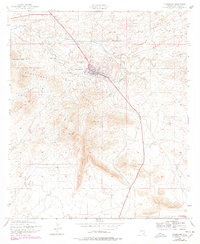
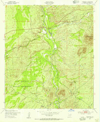
1952 Map of Tombstone
USGS Topo · Published 1978About this map
Tombstone and the surrounding Tombstone Hills appear in this mid-century survey, revised with additions in the late 1970s. The town site remains the central focus, anchored by the iconic Boothill Cem to the north and the Schieffelin Monument marking the grave of the town's founder. The landscape is a network of dry watercourses like Walnut Gulch and Tombstone Gulch, interspersed with prominent high points including Ajax Hill, Military Hill, and Comstock Hill.
Find a feature on this map
22 named features on this map. Tap any name to fly to it.
Don’t see what you’re looking for? This feature index may not catch every label — zoom into the map to look around manually.
Map Details
Editions of this 1952 Tombstone Map
3 editions found
Other maps of this area

1915 · Benson
USGS Topo · 1:125,000

1916 · Pearce
USGS Topo · 1:125,000

1922 · St. David
USGS Topo · 1:62,500

1925 · Gleeson
USGS Topo · 1:62,500

1926 · Courtland
USGS Topo · 1:62,500

1932 · Fairbank
USGS Topo · 1:62,500

1943 · Benson
USGS Topo · 1:125,000

1952 · Tombstone SE
USGS Topo · 1:24,000
1952 · Lewis Springs
USGS Topo · 1:24,000
1952 · Fairbank
USGS Topo · 1:24,000