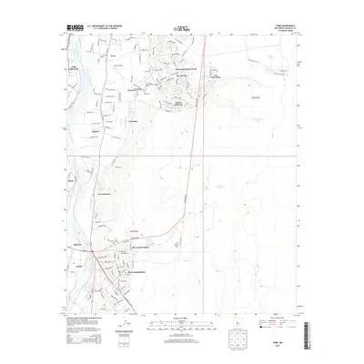
2013 Map of Tome
USGS Topo · Published 2013About this map
The Rio Grande corridor in Valencia County defines this landscape, where a sophisticated network of historical irrigation and drainage systems supports a string of traditional settlements. Communities such as Tome and La Constancia are anchored by the Tome Ditch and La Constancia Ditch, illustrating the persistent reliance on acequia-style water management. Near the Tome Cem, the map shows the transition from the river valley floor to the rising terrain of La Loma Alta, where newer developments like Rio Communities and Rio del Oro have expanded toward the eastern mesas. This 2013 survey also highlights regional educational infrastructure at the Univ of New Mexico-Valencia County Branch, situated between the older agricultural core and the modern residential blocks of Pasitos del Cielo. The western edge is defined by the industrial and transport hub of Belen, where the Lower Belen Riverside Drain marks the boundary of the irrigated valley.
Find a feature on this map
90 named features on this map. Tap any name to fly to it.
Don’t see what you’re looking for? This feature index may not catch every label — zoom into the map to look around manually.
Map Details
Editions of this 2013 Tome Map
This is the sole edition of this map. No revisions or reprints were ever made.
Other maps of this area

1952 · Dalies
USGS Topo · 1:24,000

1952 · Tome SE
USGS Topo · 1:24,000

1952 · Tome NE
USGS Topo · 1:24,000

1952 · Belen
USGS Topo · 1:24,000

1952 · Turn
USGS Topo · 1:24,000

1952 · Veguita
USGS Topo · 1:24,000

1952 · Tome
USGS Topo · 1:24,000

1952 · Los Lunas SE
USGS Topo · 1:24,000

1952 · Los Lunas
USGS Topo · 1:24,000

1954 · Socorro
USGS Topo · 1:250,000