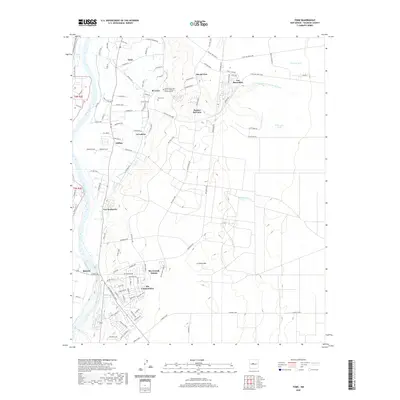
2020 Map of Tome
USGS Topo · Published 2020About this map
Tome and the surrounding Valencia County settlements sit perched between the eastern banks of the Rio Grande and the high desert terrain to the east. This modern survey illustrates the dense network of local roads and residential loops that characterize the growing communities of El Cerro, Rio Communities, and Las Maravillas. The landscape is a mix of traditional agricultural roots and contemporary development, anchored by the University of New Mexico - Valencia County Branch and the historic Tome Cem.
Find a feature on this map
102 named features on this map. Tap any name to fly to it.
Don’t see what you’re looking for? This feature index may not catch every label — zoom into the map to look around manually.
Map Details
Editions of this 2020 Tome Map
This is the sole edition of this map. No revisions or reprints were ever made.
Other maps of this area

1952 · Dalies
USGS Topo · 1:24,000

1952 · Tome SE
USGS Topo · 1:24,000

1952 · Tome NE
USGS Topo · 1:24,000

1952 · Belen
USGS Topo · 1:24,000

1952 · Turn
USGS Topo · 1:24,000

1952 · Veguita
USGS Topo · 1:24,000

1952 · Tome
USGS Topo · 1:24,000

1952 · Los Lunas SE
USGS Topo · 1:24,000

1952 · Los Lunas
USGS Topo · 1:24,000

1954 · Socorro
USGS Topo · 1:250,000