2023 Map of Tome
USGS Topo · Published 2023About this map
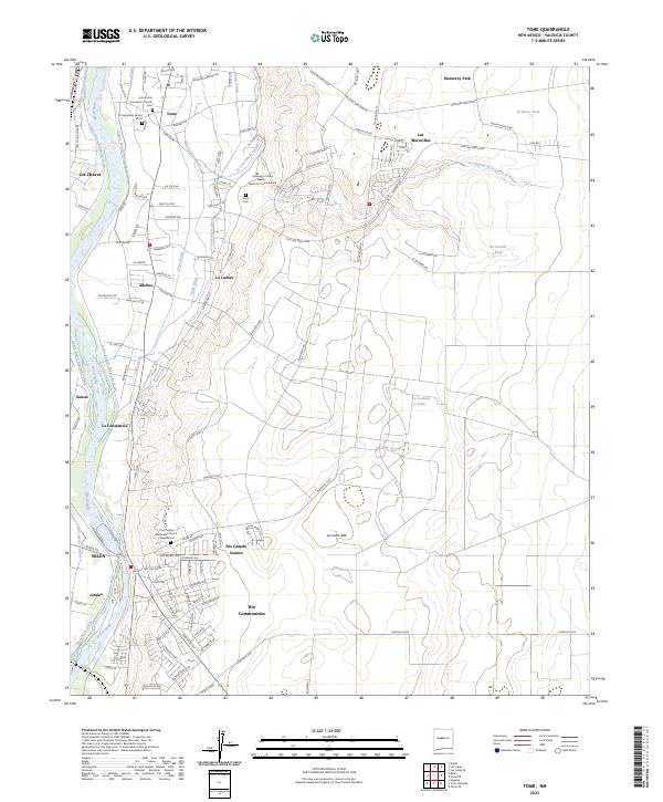
Rio Grande waters dominate the western edge of this landscape, supporting a complex network of irrigation that includes the Tome Ditch, Tome Drain, and La Constancia Lateral. This water system sustains the agricultural heritage of the valley, where traditional settlements like Tome and La Constancia sit alongside modern developments such as Rio Grande Estates and Monterey Park. The community's spiritual and educational foundations are anchored by the Immaculate Conception Church and the University of New Mexico - Valencia County Branch.
Find a feature on this map
86 named features on this map. Tap any name to fly to it.
Don’t see what you’re looking for? This feature index may not catch every label — zoom into the map to look around manually.
Map Details
Editions of this 2023 Tome Map
This is the sole edition of this map. No revisions or reprints were ever made.