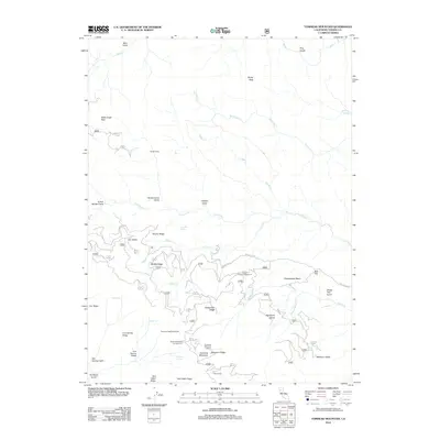
2012 Map of Tomhead Mountain
USGS Topo · Published 2012About this map
Tomhead Mountain and its prominent Tomhead Mountain Lookout serve as the geographic anchor for this section of Tehama County. The landscape is defined by a complex network of ridges and gulches, including Nuisance Ridge, Brushy Ridge, and Syd Cabin Ridge, which divide the drainages of the Cold Fork and Stinking Cr. This area is characterized by seasonal camps and high-altitude glades, such as Appletree Glade and Attlebury Glade, connected by remote forest routes like Forest Rte 35. Numerous water sources, including Miners Cabin Spring, Lone Pine Springs, and Stinking Springs, reflect a history of backcountry utility. The placement of the Tomhead Saddle Trailhead and established sites like Saddle Camp Campground highlights the area's continued use as a gateway for mountain navigation and surveillance.
Find a feature on this map
56 named features on this map. Tap any name to fly to it.
Don’t see what you’re looking for? This feature index may not catch every label — zoom into the map to look around manually.
Map Details
Editions of this 2012 Tomhead Mountain Map
This is the sole edition of this map. No revisions or reprints were ever made.
Other maps of this area

1890 · Red Bluff
USGS Topo · 1:250,000

1894 · Red Bluff
USGS Topo · 1:250,000

1949 · Colyear Springs
USGS Topo · 1:62,500

1951 · Chanchelulla Peak
USGS Topo · 1:62,500

1952 · Ono
USGS Topo · 1:62,500

1954 · Yolla Bolly
USGS Topo · 1:62,500

1957 · Colyear Springs
USGS Topo · 1:62,500

1958 · Redding
USGS Topo · 1:250,000
1967 · Cold Fork
USGS Topo · 1:24,000
1967 · Raglin Ridge
USGS Topo · 1:24,000