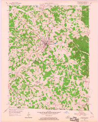
1954 Map of Tompkinsville
USGS Topo · Published 1967About this map
Tompkinsville serves as the central hub of this Monroe County landscape, situated where the Cordell Hull Highway and Tower Highway converge. The area is defined by its deep spiritual and educational heritage, evidenced by the high density of country churches and schools that once anchored these rural communities. Most notable is the Old Mulkey Meeting House State Park, preserving a historic place of worship just south of the main town.
Find a feature on this map
57 named features on this map. Tap any name to fly to it.
Don’t see what you’re looking for? This feature index may not catch every label — zoom into the map to look around manually.
Map Details
Editions of this 1954 Tompkinsville Map
3 editions found
Other maps of this area

1929 · Tompkinsville
USGS Topo · 1:62,500

1931 · Red Boiling Springs
USGS Topo · 1:62,500

1953 · Sulphur Lick
USGS Topo · 1:24,000

1953 · Freedom
USGS Topo · 1:24,000

1953 · Dubre
USGS Topo · 1:24,000

1954 · Gamaliel
USGS Topo · 1:24,000

1954 · Tompkinsville
USGS Topo · 1:24,000
1954 · Vernon
USGS Topo · 1:24,000

1956 · Corbin
USGS Topo · 1:250,000

1958 · Corbin
USGS Topo · 1:250,000