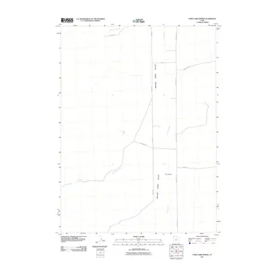
2011 Map of Toms Cabin Spring
USGS Topo · Published 2011About this map
Grouse Creek Valley defines this arid landscape in Box Elder County, where a network of remote roads and intermittent water sources supported the ranching and transit history of northwestern Utah. The map focuses on the drainage systems of Grouse Creek, Dairy Valley Creek, and Toms Cabin Creek, which flow toward the valley floor from the surrounding high country. A significant local landmark, Toms Cabin Spring, provides a point of historical interest for those researching early water rights or high-desert homesteading. The roadway network, including Jack Kimber Rd and Keg Springs Rd, provides a clear view of the rural infrastructure connecting this isolated area. The distinct geological profile of The Buttes rises above the valley, serving as a traditional navigational marker in this corner of the state.
Find a feature on this map
13 named features on this map. Tap any name to fly to it.
Don’t see what you’re looking for? This feature index may not catch every label — zoom into the map to look around manually.
Map Details
Editions of this 2011 Toms Cabin Spring Map
This is the sole edition of this map. No revisions or reprints were ever made.
Other maps of this area

1954 · Brigham City
USGS Topo · 1:250,000

1955 · Wells
USGS Topo · 1:250,000

1958 · Wells
USGS Topo · 1:250,000

1958 · Brigham City
USGS Topo · 1:250,000

1961 · Wells
USGS Topo · 1:250,000

1961 · Dairy Valley
USGS Topo · 1:62,500

1962 · Brigham City
USGS Topo · 1:250,000

1967 · Jackson Spring
USGS Topo · 1:24,000
1967 · Lucin NW
USGS Topo · 1:24,000

1967 · Lucin NE
USGS Topo · 1:24,000