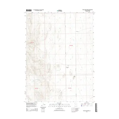
2014 Map of Toms Cabin Spring
USGS Topo · Published 2014About this map
Toms Cabin Spring and its namesake drainage, Toms Cabin Cr, anchor the western portion of this high-elevation landscape in Box Elder County. The terrain is defined by the broad Grouse Creek Valley, which runs north-to-south through the center of the sheet, flanked by the distinct elevations of The Buttes. This area represents a sparsely populated ranching and grazing environment where water sources like Dairy Valley Cr and the main channel of Grouse Cr are the primary drivers of land use. A sparse network of unpaved corridors, including Etna Rd and Reg Springs Rd, provides access across the township lines of T10N and T9N. The map illustrates the fundamental relationship between isolated water points and the expansive valley floors of northern Utah.
Find a feature on this map
14 named features on this map. Tap any name to fly to it.
Don’t see what you’re looking for? This feature index may not catch every label — zoom into the map to look around manually.
Map Details
Editions of this 2014 Toms Cabin Spring Map
This is the sole edition of this map. No revisions or reprints were ever made.
Other maps of this area

1954 · Brigham City
USGS Topo · 1:250,000

1955 · Wells
USGS Topo · 1:250,000

1958 · Wells
USGS Topo · 1:250,000

1958 · Brigham City
USGS Topo · 1:250,000

1961 · Wells
USGS Topo · 1:250,000

1961 · Dairy Valley
USGS Topo · 1:62,500

1962 · Brigham City
USGS Topo · 1:250,000

1967 · Jackson Spring
USGS Topo · 1:24,000
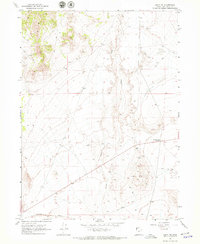
1967 · Lucin NW
USGS Topo · 1:24,000

1967 · Lucin NE
USGS Topo · 1:24,000