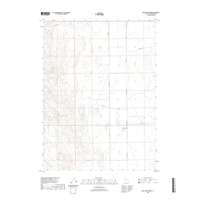
2020 Map of Toms Cabin Spring
USGS Topo · Published 2020About this map
Toms Cabin Spring serves as a central landmark in this high-desert landscape of western Box Elder County. The terrain is defined by drainage patterns and seasonal watercourses, including Toms Cabin Cr, Dairy Valley Cr, and the more prominent Grouse Cr. These features have long dictated the movement of travelers and cattle through this arid corridor of Utah. A network of unpaved tracks, such as Death Valley Rd and Keg Springs Rd, provides access across the basin floors and through the gaps between prominent local elevations like The Buttes. The placement of Tom Cabin Rd and S Tom Cabin Rd suggests the historical importance of the spring as a reliable water source in a region where such resources are scarce. This topography illustrates the enduring character of the Great Basin, where land use is inextricably tied to the few available springs and creeks.
Find a feature on this map
13 named features on this map. Tap any name to fly to it.
Don’t see what you’re looking for? This feature index may not catch every label — zoom into the map to look around manually.
Map Details
Editions of this 2020 Toms Cabin Spring Map
This is the sole edition of this map. No revisions or reprints were ever made.
Other maps of this area

1954 · Brigham City
USGS Topo · 1:250,000

1955 · Wells
USGS Topo · 1:250,000

1958 · Wells
USGS Topo · 1:250,000

1958 · Brigham City
USGS Topo · 1:250,000

1961 · Wells
USGS Topo · 1:250,000

1961 · Dairy Valley
USGS Topo · 1:62,500

1962 · Brigham City
USGS Topo · 1:250,000

1967 · Jackson Spring
USGS Topo · 1:24,000
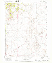
1967 · Lucin NW
USGS Topo · 1:24,000

1967 · Lucin NE
USGS Topo · 1:24,000