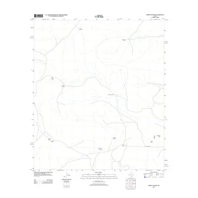
2012 Map of Toms Canyon
USGS Topo · Published 2012About this map
Toms Canyon and the high desert of Pecos County are defined by a network of ephemeral watercourses and vital ranching infrastructure. The landscape is interconnected by the Old Downie Rd, which leads toward the Downie Ranch in the southeastern portion of the map. This area's reliance on groundwater is evident through the numerous named landmarks such as Cliett Windmills, Yerbuena Windmill, and Joes Booster Windmill, which serve as critical survival points in this arid terrain. High points like Two Top Mtn and the passage at Standifer Gap provide topographic orientation amidst the winding paths of Vega Draw, Fortyone Draw, and Pyle Draw. The map captures a ranching territory where geographic features and family-named infrastructure are the primary markers of human presence.
Find a feature on this map
14 named features on this map. Tap any name to fly to it.
Don’t see what you’re looking for? This feature index may not catch every label — zoom into the map to look around manually.
Map Details
Editions of this 2012 Toms Canyon Map
This is the sole edition of this map. No revisions or reprints were ever made.
Other maps of this area

1920 · Longfellow
USGS Topo · 1:125,000

1928 · Sanderson
USGS Topo · 1:125,000

1954 · Fort Stockton
USGS Topo · 1:250,000

1958 · Fort Stockton
USGS Topo · 1:250,000

1968 · Busher Canyon
USGS Topo · 1:24,000

1968 · Toms Canyon
USGS Topo · 1:24,000

1968 · F C Ranch
USGS Topo · 1:24,000

1968 · Longfellow
USGS Topo · 1:24,000

1968 · Ebers Camp
USGS Topo · 1:24,000

1968 · Ninemile Ranch
USGS Topo · 1:24,000