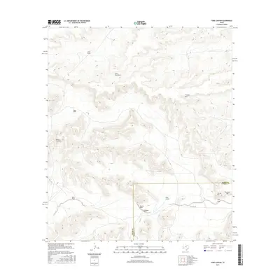
2016 Map of Toms Canyon
USGS Topo · Published 2016About this map
The Wildcat Mountains dominate the western landscape of this Trans-Pecos region, where the high desert terrain is defined by a complex network of seasonal drainages. Local landmarks such as Cliett Draw, Clark Place Draw, and Vega Draw suggest a history of ranching and land use tied to these intermittent water sources. The southern portion of the map is marked by the Pecos and Terrell County line, crossing through the prominent Toms Canyon and near the distinct peaks of Two Top Mtn.
Find a feature on this map
13 named features on this map. Tap any name to fly to it.
Don’t see what you’re looking for? This feature index may not catch every label — zoom into the map to look around manually.
Map Details
Editions of this 2016 Toms Canyon Map
This is the sole edition of this map. No revisions or reprints were ever made.
Other maps of this area

1920 · Longfellow
USGS Topo · 1:125,000

1928 · Sanderson
USGS Topo · 1:125,000

1954 · Fort Stockton
USGS Topo · 1:250,000

1958 · Fort Stockton
USGS Topo · 1:250,000

1968 · Busher Canyon
USGS Topo · 1:24,000

1968 · Toms Canyon
USGS Topo · 1:24,000

1968 · F C Ranch
USGS Topo · 1:24,000

1968 · Longfellow
USGS Topo · 1:24,000

1968 · Ebers Camp
USGS Topo · 1:24,000

1968 · Ninemile Ranch
USGS Topo · 1:24,000