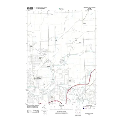
2010 Map of Tonawanda East
USGS Topo · Published 2010About this map
Tonawanda Creek serves as the central artery for this Western New York landscape, carving a meandering path that separates the developed southern suburbs from the more rural north. The area exhibits a transition from the dense street grids of North Tonawanda and Tonawanda in the southwest toward the residential clusters of Getzville and Skinnersville. Genealogical interest is particularly high here, as the map records a high density of burial grounds including Wheatfield Cemetery, Saint Pauls Cemetery, and the expansive Acacia Park Cemetery. Smaller hamlets like Beach Ridge, Hoffman, and Wendelville are connected by a network of drainage-conscious roads following Bull Creek and Ellicott Creek. The presence of several small airfields, such as Smith Airport and Pendleton Airpark, reflects the region's mid-century aviation heritage amidst its steady suburban expansion.
Find a feature on this map
70 named features on this map. Tap any name to fly to it.
Don’t see what you’re looking for? This feature index may not catch every label — zoom into the map to look around manually.
Map Details
Editions of this 2010 Tonawanda East Map
This is the sole edition of this map. No revisions or reprints were ever made.
Other maps of this area

1894 · Buffalo
USGS Topo · 1:62,500

1897 · Tonawanda
USGS Topo · 1:62,500

1897 · Lockport
USGS Topo · 1:62,500

1899 · Niagara
USGS Topo · 1:125,000

1900 · Tonawanda
USGS Topo · 1:62,500

1901 · Buffalo
USGS Topo · 1:62,500

1901 · Tonawanda
USGS Topo · 1:62,500

1902 · Lockport
USGS Topo · 1:62,500

1905 · Depew
USGS Topo · 1:62,500

1905 · Lockport
USGS Topo · 1:62,500