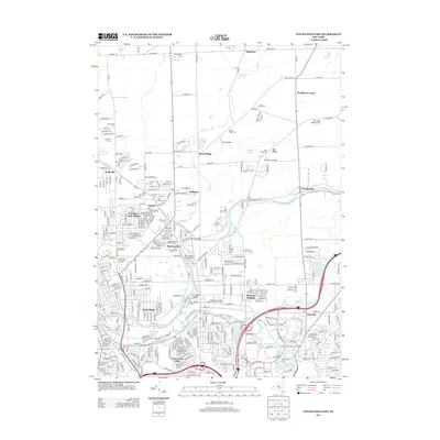
2013 Map of Tonawanda East
USGS Topo · Published 2013About this map
Tonawanda Creek meanders through the landscape, serving as a primary geographic anchor for the numerous communities that line its banks. The area reflects a transition from the agricultural roots visible at Pumpkin Farm and small settlements like Mapleton and Nashville to the more structured suburban developments of Wurlitzer Park Village and Green Acres Valley. A remarkable density of burial grounds, including White Chapel Memorial Cem and Acacia Park Cem, suggests a long history of local congregation and memory. The presence of Smith Airport and Pendleton Airpark indicates the area's continued role in local aviation, while higher education institutions such as the Bryant And Stratton College-Amherst Campus point toward modern residential and commercial growth. From the crossing at Picard Bridge to the isolated Threemile Island, the map documents a complex network of waterways and roads connecting historic hamlets.
Find a feature on this map
210 named features on this map. Tap any name to fly to it.
Don’t see what you’re looking for? This feature index may not catch every label — zoom into the map to look around manually.
Map Details
Editions of this 2013 Tonawanda East Map
This is the sole edition of this map. No revisions or reprints were ever made.
Other maps of this area

1894 · Buffalo
USGS Topo · 1:62,500

1897 · Tonawanda
USGS Topo · 1:62,500

1897 · Lockport
USGS Topo · 1:62,500

1899 · Niagara
USGS Topo · 1:125,000

1900 · Tonawanda
USGS Topo · 1:62,500

1901 · Buffalo
USGS Topo · 1:62,500

1901 · Tonawanda
USGS Topo · 1:62,500

1902 · Lockport
USGS Topo · 1:62,500

1905 · Depew
USGS Topo · 1:62,500

1905 · Lockport
USGS Topo · 1:62,500