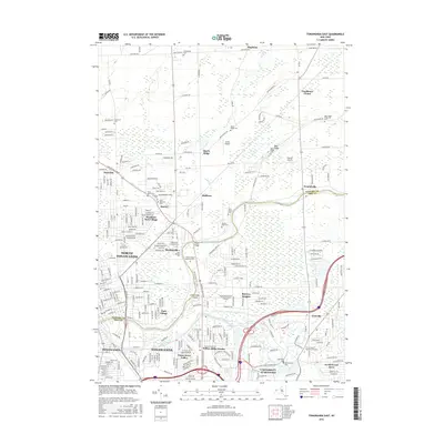
2016 Map of Tonawanda East
USGS Topo · Published 2016About this map
Tonawanda Creek serves as a natural boundary between Erie and Niagara Counties, anchoring a landscape defined by suburban expansion and historical crossroads. The transition from the industrial heritage of North Tonawanda and Tonawanda in the southwest to the collegiate sprawl of the University At Buffalo highlights the region's evolving character. Residential clusters such as Wurlitzer Park Village and Willow Ridge Estates reveal the mid-century to modern growth patterns of the Buffalo-Niagara metropolitan area.
Find a feature on this map
170 named features on this map. Tap any name to fly to it.
Don’t see what you’re looking for? This feature index may not catch every label — zoom into the map to look around manually.
Map Details
Editions of this 2016 Tonawanda East Map
This is the sole edition of this map. No revisions or reprints were ever made.
Other maps of this area

1894 · Buffalo
USGS Topo · 1:62,500

1897 · Tonawanda
USGS Topo · 1:62,500

1897 · Lockport
USGS Topo · 1:62,500

1899 · Niagara
USGS Topo · 1:125,000

1900 · Tonawanda
USGS Topo · 1:62,500

1901 · Buffalo
USGS Topo · 1:62,500

1901 · Tonawanda
USGS Topo · 1:62,500

1902 · Lockport
USGS Topo · 1:62,500

1905 · Depew
USGS Topo · 1:62,500

1905 · Lockport
USGS Topo · 1:62,500