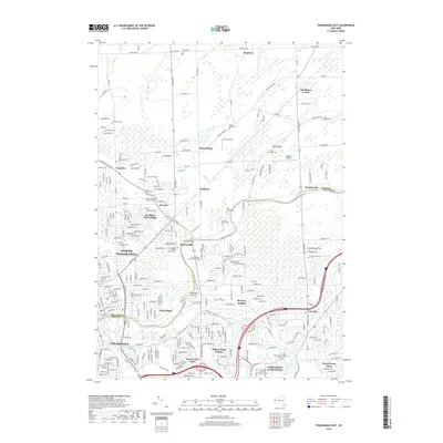
2019 Map of Tonawanda East
USGS Topo · Published 2019About this map
Tonawanda Creek serves as a defining boundary in this suburban landscape, separating Niagara and Erie counties as it flows past the established communities of North Tonawanda and Tonawanda. The map reveals a transition from dense residential grids in the south toward the more open, expanding developments of Getzville and the sprawling University at Buffalo North Campus. Local history is deeply etched into the terrain through numerous memorial grounds, including the large Acacia Park Cem and White Chapel Memorial Cem. To the north, the character remains more rural with named crossroads like Pendleton Center and Wendelville dotting the map along with local landmarks such as Smith Airport and Flying F Airport. The proximity of the Niagara Falls Blvd corridor highlights the transportation network connecting these riverside settlements to the larger regional centers.
Find a feature on this map
61 named features on this map. Tap any name to fly to it.
Don’t see what you’re looking for? This feature index may not catch every label — zoom into the map to look around manually.
Map Details
Editions of this 2019 Tonawanda East Map
This is the sole edition of this map. No revisions or reprints were ever made.
Other maps of this area

1894 · Buffalo
USGS Topo · 1:62,500

1897 · Tonawanda
USGS Topo · 1:62,500

1897 · Lockport
USGS Topo · 1:62,500

1899 · Niagara
USGS Topo · 1:125,000

1900 · Tonawanda
USGS Topo · 1:62,500

1901 · Buffalo
USGS Topo · 1:62,500

1901 · Tonawanda
USGS Topo · 1:62,500

1902 · Lockport
USGS Topo · 1:62,500

1905 · Depew
USGS Topo · 1:62,500

1905 · Lockport
USGS Topo · 1:62,500