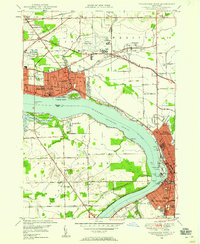
1948 Map of Tonawanda West
USGS Topo · Published 1958About this map
Niagara Falls and the surrounding industrial corridor along the Niagara River Tonawanda Channel define this mid-century landscape. The map details the urban density of North Tonawanda and Tonawanda, where the Erie RR and New York Central RR converge near the riverbank. This era shows the residential expansion of La Salle and the prominence of the Niagara Falls Municipal Airport, which is situated north of the city center among smaller rural hamlets like Bergholtz and St Johnsburg.
Find a feature on this map
98 named features on this map. Tap any name to fly to it.
Don’t see what you’re looking for? This feature index may not catch every label — zoom into the map to look around manually.
Map Details
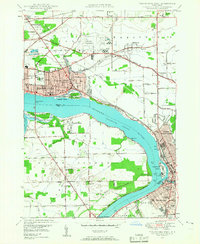
Editions of this 1948 Tonawanda West Map
2 editions found
Other maps of this area

1894 · Buffalo
USGS Topo · 1:62,500

1894 · Niagara Falls
USGS Topo · 1:62,500

1896 · Niagara Falls
USGS Topo · 1:62,500

1897 · Tonawanda
USGS Topo · 1:62,500

1899 · Niagara
USGS Topo · 1:125,000

1900 · Tonawanda
USGS Topo · 1:62,500

1900 · Niagara Falls
USGS Topo · 1:62,500

1901 · Buffalo
USGS Topo · 1:62,500

1901 · Niagara Falls
USGS Topo · 1:62,500

1901 · Tonawanda
USGS Topo · 1:62,500